Aveley night lights from space
Night Light of Aveley (Western Australia) from space (Australia) Src. Average luminocity for 10x10km area is 40.0055% and for 50x50km: 28.8919%.
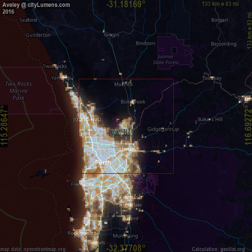
Analysis of Aveley night lights 2016
Square area 10x10 km:
 1.65%
1.65%90-99
3.48%80-89
2.93%70-79
2.75%60-69
14.47%50-59
12.09%40-49
5.68%30-39
12.09%20-29
15.93%10-19
24.36%0-9
4.58%Square area 50x50 km:
7%90-99
7.27%80-89
2.84%70-79
3.7%60-69
5.53%50-59
3.29%40-49
2.06%30-39
3.06%20-29
4.33%10-19
5.52%0-9
55.4%Clear (daylight) street map image can be seen on geolist.org.
Map coordinates:
31° 10' 54.1" South, 115° 17' 11.3" East
31° 46' 52.8" South, 115° 59' 22.5" East
32° 22' 37.5" South, 116° 41' 33.8" East
Some cities around Aveley sort by population:
• Ellenbrook
2.5 km =1.6 mi,  309°
309°
• Ballajura
11.1 km =6.9 mi,  233°
233°
• Landsdale
12 km =7.5 mi,  256°
256°
• Beechboro
10.6 km =6.6 mi,  208°
208°
• Midland
12.1 km =7.5 mi,  170°
170°
• Bennett Springs
9.6 km =6 mi, 205°
• Caversham
11.5 km =7.1 mi,  190°
190°
• Bullsbrook
12.5 km =7.8 mi,  4°
4°
8348276 (p: 9,952)
Sources (retrieved 2019-11-25):
» Earth at Night: Flat Maps 2012, 2016