Darch night lights from space
Night Light of Darch (Western Australia) from space (Australia) Src. Average luminocity for 10x10km area is 75.9359% and for 50x50km: 33.5917%.
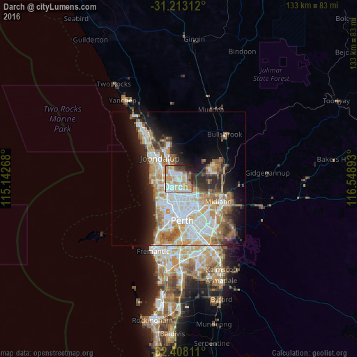
Analysis of Darch night lights 2016
Square area 10x10 km:
 17.95%
90-99
21.98%80-89
10.99%70-79
18.5%60-69
9.34%50-59
4.4%40-49
4.21%30-39
5.49%20-29
4.58%10-19
2.56%0-9
0%Square area 50x50 km:
7.76%90-99
8.16%80-89
3.33%70-79
4.71%60-69
6.34%50-59
3.63%40-49
2.44%30-39
3.28%20-29
5.65%10-19
8.98%0-9
45.74%Clear (daylight) street map image can be seen on geolist.org.
Map coordinates:
31° 12' 47.2" South, 115° 8' 33.6" East
31° 48' 45.2" South, 115° 50' 44.9" East
32° 24' 29.2" South, 116° 32' 56.1" East
Some cities around Darch sort by population:
• Kingsley
4.3 km =2.7 mi,  273°
273°
• Balga
4.7 km =2.9 mi,  186°
186°
• Landsdale
2 km =1.2 mi,  73°
73°
• Marangaroo
1.8 km =1.1 mi,  203°
203°
• Greenwood
4.4 km =2.7 mi,  248°
248°
• Girrawheen
3.2 km =2 mi, 190°
• Alexander Heights
2.5 km =1.6 mi,  132°
132°
• Madeley
1.7 km =1.1 mi,  275°
275°
8348333 (p: 6,969)
Sources (retrieved 2019-11-25):
» Earth at Night: Flat Maps 2012, 2016