Bennett Springs night lights from space
Night Light of Bennett Springs (Western Australia) from space (Australia) Src. Average luminocity for 10x10km area is 60.9597% and for 50x50km: 38.1216%.
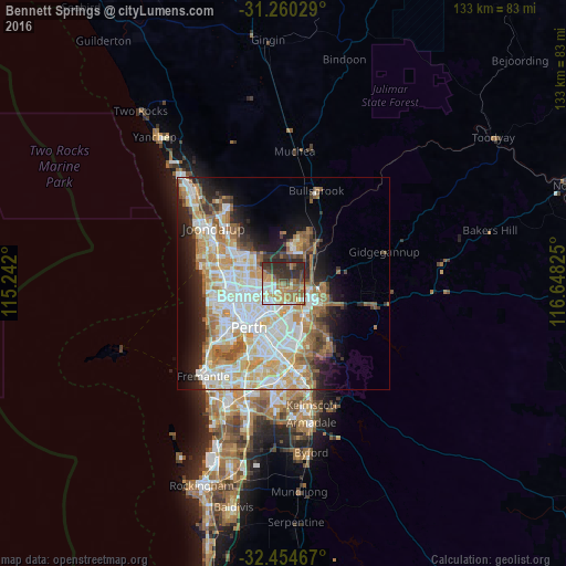
Analysis of Bennett Springs night lights 2016
Square area 10x10 km:
 8.79%
8.79%90-99
10.44%80-89
5.68%70-79
12.09%60-69
19.78%50-59
6.59%40-49
8.06%30-39
12.45%20-29
16.12%10-19
0%0-9
0%Square area 50x50 km:
8.88%90-99
9.67%80-89
4.44%70-79
5.77%60-69
6.57%50-59
3.81%40-49
2.52%30-39
3.34%20-29
5.98%10-19
8.04%0-9
40.97%Clear (daylight) street map image can be seen on geolist.org.
Map coordinates:
31° 15' 37" South, 115° 14' 31.2" East
31° 51' 33.9" South, 115° 56' 42.4" East
32° 27' 16.8" South, 116° 38' 53.7" East
Some cities around Bennett Springs sort by population:
• Morley
4.6 km =2.9 mi,  226°
226°
• Ballajura
5.1 km =3.2 mi,  294°
294°
• Bayswater
6.9 km =4.3 mi,  202°
202°
• Bassendean
5.5 km =3.4 mi,  181°
181°
• Beechboro
1 km =0.6 mi, 231°
• Noranda
4.6 km =2.9 mi,  250°
250°
• Midland
7 km =4.3 mi,  118°
118°
• Caversham
3.3 km =2.1 mi,  142°
142°
11704298 (p: 5,246)
Sources (retrieved 2019-11-25):
» Earth at Night: Flat Maps 2012, 2016