Springvale South night lights from space
Night Light of Springvale South (Victoria) from space (Australia) Src. Average luminocity for 10x10km area is 85.7143% and for 50x50km: 44.4922%.
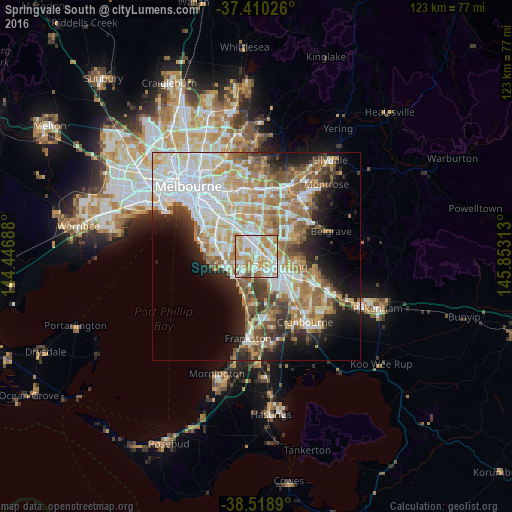
Analysis of Springvale South night lights 2016
Square area 10x10 km:
 23.38%
90-99
26.46%80-89
12.01%70-79
24.03%60-69
10.55%50-59
3.25%40-49
0.32%30-39
0%20-29
0%10-19
0%0-9
0%Square area 50x50 km:
10.98%90-99
9.92%80-89
5.07%70-79
7.48%60-69
7.07%50-59
5.91%40-49
3.91%30-39
3.88%20-29
5.68%10-19
9.24%0-9
30.85%Clear (daylight) street map image can be seen on geolist.org.
Map coordinates:
37° 24' 36.9" South, 144° 26' 48.8" East
37° 58' 0" South, 145° 9' 0" East
38° 31' 8" South, 145° 51' 11.3" East
Some cities around Springvale South sort by population:
• Noble Park
1.5 km =0.9 mi,  90°
90°
• Dandenong
4.8 km =3 mi,  112°
112°
• Keysborough
3.4 km =2.1 mi,  142°
142°
• Dandenong North
5.1 km =3.2 mi, 89°
• Mulgrave
4.9 km =3 mi,  29°
29°
• Clayton South
4.7 km =2.9 mi,  321°
321°
• Dingley Village
2.3 km =1.4 mi,  217°
217°
• Noble Park North
4.2 km =2.6 mi,  63°
63°
2148588 (p: 12,653)
Sources (retrieved 2019-11-25):
» Earth at Night: Flat Maps 2012, 2016