Clayfield night lights from space
Night Light of Clayfield (Queensland) from space (Australia) Src. Average luminocity for 10x10km area is 94.7841% and for 50x50km: 42.0956%.
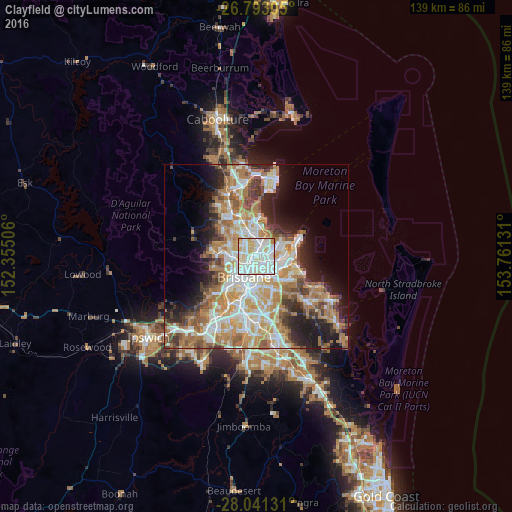
Analysis of Clayfield night lights 2016
Square area 10x10 km:
 37.5%
37.5%90-99
38.64%80-89
18.94%70-79
3.41%60-69
1.33%50-59
0.19%40-49
0%30-39
0%20-29
0%10-19
0%0-9
0%Square area 50x50 km:
8.4%90-99
9.17%80-89
5.45%70-79
5.94%60-69
10.9%50-59
3.83%40-49
4.14%30-39
4.08%20-29
6.45%10-19
9.43%0-9
32.22%Clear (daylight) street map image can be seen on geolist.org.
Map coordinates:
26° 47' 35" South, 152° 21' 18.2" East
27° 25' 8.2" South, 153° 3' 29.4" East
28° 2' 28.7" South, 153° 45' 40.7" East
Some cities around Clayfield sort by population:
• Nundah
1.9 km =1.2 mi,  10°
10°
• Wavell Heights
3 km =1.9 mi,  338°
338°
• Kedron
3.3 km =2.1 mi,  302°
302°
• Hamilton
2.3 km =1.4 mi,  168°
168°
• Windsor
3.5 km =2.2 mi,  236°
236°
• Bulimba
3.4 km =2.1 mi,  180°
180°
• Ascot
1.4 km =0.9 mi, 180°
• Teneriffe
4.3 km =2.7 mi,  195°
195°
6943581 (p: 10,323)
Sources (retrieved 2019-11-25):
» Earth at Night: Flat Maps 2012, 2016