Kedron night lights from space
Night Light of Kedron (Queensland) from space (Australia) Src. Average luminocity for 10x10km area is 90.9413% and for 50x50km: 40.5017%.
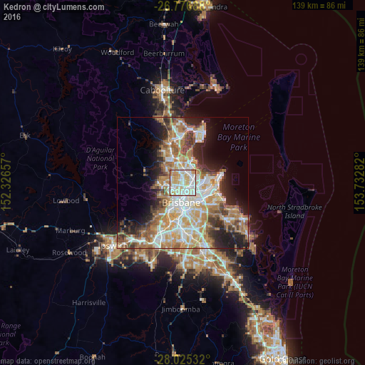
Analysis of Kedron night lights 2016
Square area 10x10 km:
 26.89%
90-99
32.39%80-89
25.19%70-79
12.5%60-69
3.03%50-59
0%40-49
0%30-39
0%20-29
0%10-19
0%0-9
0%Square area 50x50 km:
8.16%90-99
8.9%80-89
5.32%70-79
5.71%60-69
10.19%50-59
3.33%40-49
4.08%30-39
4.04%20-29
6.4%10-19
9.12%0-9
34.76%Clear (daylight) street map image can be seen on geolist.org.
Map coordinates:
26° 46' 36.8" South, 152° 19' 35.7" East
27° 24' 10.3" South, 153° 1' 46.9" East
28° 1' 31.2" South, 153° 43' 58.2" East
Some cities around Kedron sort by population:
• Nundah
3.2 km =2 mi,  89°
89°
• Clayfield
3.3 km =2.1 mi,  122°
122°
• Chermside
2 km =1.2 mi,  2°
2°
• Wavell Heights
2 km =1.2 mi,  59°
59°
• Windsor
3.7 km =2.3 mi,  181°
181°
• Stafford Heights
2.2 km =1.4 mi,  298°
298°
• Stafford
2 km =1.2 mi,  245°
245°
• Chermside West
2.5 km =1.6 mi,  327°
327°
8348750 (p: 9,117)
Sources (retrieved 2019-11-25):
» Earth at Night: Flat Maps 2012, 2016