Nundah night lights from space
Night Light of Nundah (Queensland) from space (Australia) Src. Average luminocity for 10x10km area is 91.7708% and for 50x50km: 40.4382%.
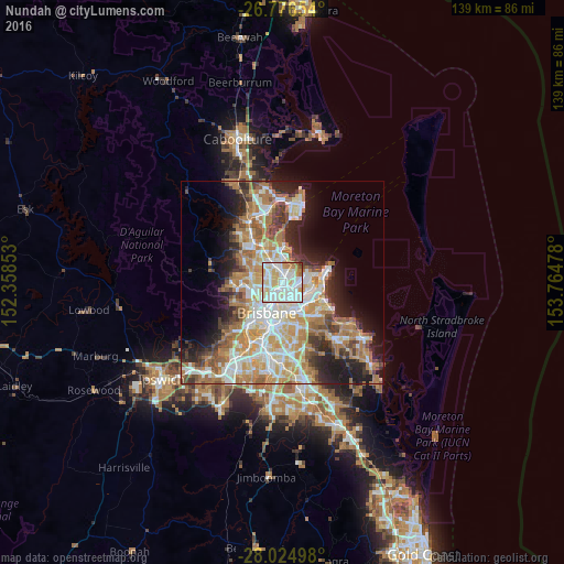
Analysis of Nundah night lights 2016
Square area 10x10 km:
 33.33%
90-99
35.61%80-89
16.67%70-79
5.87%60-69
6.25%50-59
1.52%40-49
0.19%30-39
0.57%20-29
0%10-19
0%0-9
0%Square area 50x50 km:
8.11%90-99
8.89%80-89
5.31%70-79
5.75%60-69
10.2%50-59
3.25%40-49
3.93%30-39
4%20-29
6.46%10-19
9.65%0-9
34.46%Clear (daylight) street map image can be seen on geolist.org.
Map coordinates:
26° 46' 35.5" South, 152° 21' 30.7" East
27° 24' 9.1" South, 153° 3' 41.9" East
28° 1' 29.9" South, 153° 45' 53.2" East
Some cities around Nundah sort by population:
• Clayfield
1.9 km =1.2 mi,  190°
190°
• Chermside
3.6 km =2.2 mi,  302°
302°
• Wavell Heights
1.7 km =1.1 mi, 303°
• Kedron
3.2 km =2 mi,  269°
269°
• Hamilton
4.1 km =2.5 mi,  178°
178°
• Windsor
5 km =3.1 mi,  220°
220°
• Ascot
3.2 km =2 mi, 186°
• Banyo
2.8 km =1.7 mi,  37°
37°
6943548 (p: 11,823)
Sources (retrieved 2019-11-25):
» Earth at Night: Flat Maps 2012, 2016