Campsie night lights from space
Night Light of Campsie (New South Wales) from space (Australia) Src. Average luminocity for 10x10km area is 94.9038% and for 50x50km: 52.4278%.

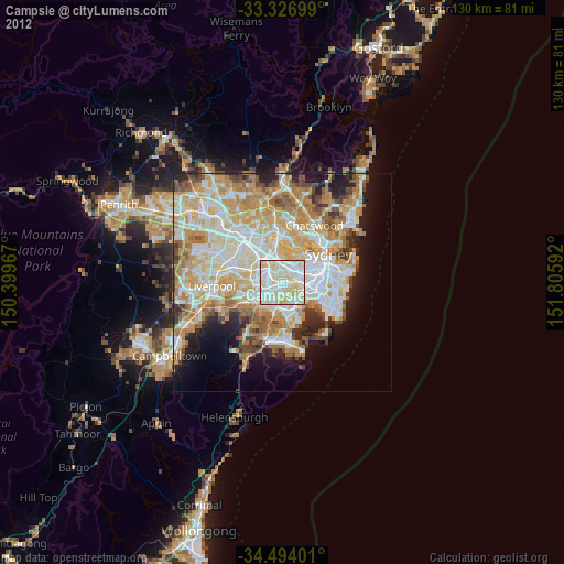
Analysis of Campsie night lights 2016
Square area 10x10 km:
 35.49%
90-99
41.26%80-89
21.5%70-79
1.75%60-69
0%50-59
0%40-49
0%30-39
0%20-29
0%10-19
0%0-9
0%Square area 50x50 km:
12.68%90-99
14.04%80-89
7.26%70-79
8.51%60-69
9.11%50-59
4.82%40-49
2.91%30-39
3.51%20-29
4.95%10-19
7.2%0-9
25%Clear (daylight) street map image can be seen on geolist.org.
Map coordinates:
33° 19' 37.2" South, 150° 23' 58.8" East
33° 54' 45" South, 151° 6' 10" East
34° 29' 38.4" South, 151° 48' 21.3" East
Some cities around Campsie sort by population:
• Ashfield
3.3 km =2.1 mi,  34°
34°
• Earlwood
2.3 km =1.4 mi,  114°
114°
• Lakemba
2.6 km =1.6 mi,  252°
252°
• Burwood
3.3 km =2.1 mi,  355°
355°
• Belmore
1.4 km =0.9 mi,  239°
239°
• Kingsgrove
3 km =1.9 mi,  186°
186°
• Canterbury
1.5 km =0.9 mi,  87°
87°
• Belfield
1.9 km =1.2 mi,  300°
300°
8348466 (p: 24,487)
Sources (retrieved 2019-11-25):
» Earth at Night: Flat Maps 2012, 2016