Kingsgrove night lights from space
Night Light of Kingsgrove (New South Wales) from space (Australia) Src. Average luminocity for 10x10km area is 92.785% and for 50x50km: 49.864%.
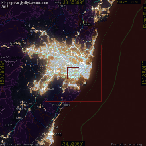
Analysis of Kingsgrove night lights 2016
Square area 10x10 km:
 29.55%
90-99
41.43%80-89
19.41%70-79
6.47%60-69
2.8%50-59
0%40-49
0.35%30-39
0%20-29
0%10-19
0%0-9
0%Square area 50x50 km:
12.53%90-99
13.77%80-89
7.06%70-79
8.05%60-69
8.09%50-59
4.27%40-49
2.49%30-39
3.13%20-29
3.93%10-19
6.37%0-9
30.3%Clear (daylight) street map image can be seen on geolist.org.
Map coordinates:
33° 21' 14.4" South, 150° 23' 46.2" East
33° 56' 21.6" South, 151° 5' 57.4" East
34° 31' 14.3" South, 151° 48' 8.7" East
Some cities around Kingsgrove sort by population:
• Campsie
3 km =1.9 mi,  6°
6°
• Bexley
2 km =1.2 mi,  126°
126°
• Earlwood
3.1 km =1.9 mi,  49°
49°
• Lakemba
3.1 km =1.9 mi,  315°
315°
• Belmore
2.4 km =1.5 mi,  337°
337°
• Roselands
2.5 km =1.6 mi,  285°
285°
• Beverly Hills
2 km =1.2 mi,  241°
241°
• Narwee
2.9 km =1.8 mi,  253°
253°
8348621 (p: 12,390)
Sources (retrieved 2019-11-25):
» Earth at Night: Flat Maps 2012, 2016