Ashfield night lights from space
Night Light of Ashfield (New South Wales) from space (Australia) Src. Average luminocity for 10x10km area is 93.6888% and for 50x50km: 51.1197%.

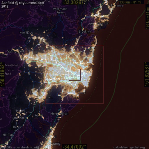
Analysis of Ashfield night lights 2016
Square area 10x10 km:
 38.46%
90-99
32.87%80-89
20.1%70-79
8.57%60-69
0%50-59
0%40-49
0%30-39
0%20-29
0%10-19
0%0-9
0%Square area 50x50 km:
12.18%90-99
13.33%80-89
7.09%70-79
8.35%60-69
9.05%50-59
4.54%40-49
2.86%30-39
3.6%20-29
5.47%10-19
8.6%0-9
24.93%Clear (daylight) street map image can be seen on geolist.org.
Map coordinates:
33° 18' 9.6" South, 150° 25' 10.6" East
33° 53' 18" South, 151° 7' 21.9" East
34° 28' 12.1" South, 151° 49' 33.1" East
Some cities around Ashfield sort by population:
• Burwood
2.2 km =1.4 mi,  284°
284°
• Leichhardt
3.1 km =1.9 mi,  79°
79°
• Dulwich Hill
2.3 km =1.4 mi,  138°
138°
• Croydon
0.8 km =0.5 mi,  314°
314°
• Five Dock
2.4 km =1.5 mi,  14°
14°
• Summer Hill
1.5 km =0.9 mi,  103°
103°
• Canterbury
2.6 km =1.6 mi,  188°
188°
• Haberfield
2 km =1.2 mi,  72°
72°
2177565 (p: 23,749)
Sources (retrieved 2019-11-25):
» Earth at Night: Flat Maps 2012, 2016