Belrose night lights from space
Night Light of Belrose (New South Wales) from space (Australia) Src. Average luminocity for 10x10km area is 51.4707% and for 50x50km: 35.083%.
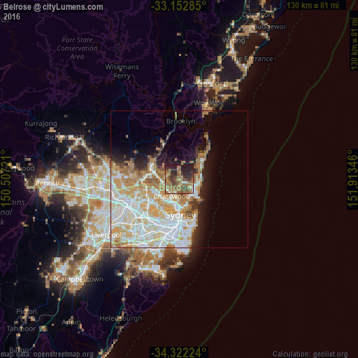
Analysis of Belrose night lights 2016
Square area 10x10 km:
 2.2%
2.2%90-99
3.3%80-89
4.03%70-79
4.21%60-69
29.85%50-59
11.54%40-49
11.36%30-39
12.64%20-29
16.12%10-19
4.76%0-9
0%Square area 50x50 km:
8.75%90-99
9.38%80-89
4.74%70-79
5.9%60-69
6.25%50-59
2.37%40-49
1.46%30-39
2.08%20-29
3.25%10-19
5.88%0-9
49.94%Clear (daylight) street map image can be seen on geolist.org.
Map coordinates:
33° 9' 10.3" South, 150° 30' 26" East
33° 44' 22.3" South, 151° 12' 37.2" East
34° 19' 20.1" South, 151° 54' 48.5" East
Some cities around Belrose sort by population:
• Saint Ives
4.8 km =3 mi,  283°
283°
• Frenchs Forest
1.5 km =0.9 mi,  128°
128°
• Killara
5.3 km =3.3 mi,  236°
236°
• Roseville
5.5 km =3.4 mi,  207°
207°
• Forestville
3 km =1.9 mi,  183°
183°
• Cromer
5.4 km =3.4 mi,  80°
80°
• Beacon Hill
4.7 km =2.9 mi,  108°
108°
• Allambie Heights
4.7 km =2.9 mi, 129°
2176245 (p: 8,714)
Sources (retrieved 2019-11-25):
» Earth at Night: Flat Maps 2012, 2016