Frenchs Forest night lights from space
Night Light of Frenchs Forest (New South Wales) from space (Australia) Src. Average luminocity for 10x10km area is 55.8645% and for 50x50km: 34.4409%.
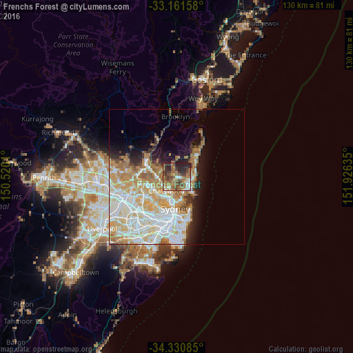
Analysis of Frenchs Forest night lights 2016
Square area 10x10 km:
 4.58%
4.58%90-99
6.59%80-89
3.85%70-79
4.21%60-69
27.84%50-59
13.55%40-49
11.9%30-39
12.82%20-29
14.1%10-19
0.55%0-9
0%Square area 50x50 km:
8.53%90-99
9.17%80-89
4.52%70-79
5.83%60-69
6.2%50-59
2.46%40-49
1.55%30-39
2.1%20-29
3.24%10-19
5.78%0-9
50.64%Clear (daylight) street map image can be seen on geolist.org.
Map coordinates:
33° 9' 41.7" South, 150° 31' 12.4" East
33° 44' 53.6" South, 151° 13' 23.6" East
34° 19' 51.1" South, 151° 55' 34.9" East
Some cities around Frenchs Forest sort by population:
• Roseville
5.4 km =3.4 mi,  223°
223°
• Belrose
1.5 km =0.9 mi,  308°
308°
• Forestville
2.5 km =1.6 mi,  213°
213°
• Cromer
4.5 km =2.8 mi,  65°
65°
• Beacon Hill
3.3 km =2.1 mi,  98°
98°
• Allambie Heights
3.2 km =2 mi,  129°
129°
• Narraweena
5 km =3.1 mi, 98°
• Manly Vale
5.4 km =3.4 mi,  138°
138°
8347809 (p: 13,278)
Sources (retrieved 2019-11-25):
» Earth at Night: Flat Maps 2012, 2016