Beacon Hill night lights from space
Night Light of Beacon Hill (New South Wales) from space (Australia) Src. Average luminocity for 10x10km area is 58.7473% and for 50x50km: 31.3188%.
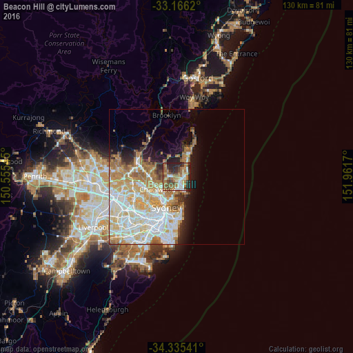
Analysis of Beacon Hill night lights 2016
Square area 10x10 km:
 6.96%
6.96%90-99
9.16%80-89
5.86%70-79
6.04%60-69
24.54%50-59
11.36%40-49
9.16%30-39
10.07%20-29
15.93%10-19
0.92%0-9
0%Square area 50x50 km:
7.81%90-99
8.21%80-89
3.92%70-79
4.97%60-69
5.98%50-59
2.38%40-49
1.5%30-39
2.04%20-29
3.03%10-19
5.5%0-9
54.64%Clear (daylight) street map image can be seen on geolist.org.
Map coordinates:
33° 9' 58.3" South, 150° 33' 19.6" East
33° 45' 10.1" South, 151° 15' 30.9" East
34° 20' 7.5" South, 151° 57' 42.1" East
Some cities around Beacon Hill sort by population:
• Dee Why
2.8 km =1.7 mi,  86°
86°
• Frenchs Forest
3.3 km =2.1 mi,  278°
278°
• Freshwater
3.8 km =2.4 mi,  138°
138°
• Collaroy
4.6 km =2.9 mi,  59°
59°
• Cromer
2.6 km =1.6 mi,  19°
19°
• Allambie Heights
1.7 km =1.1 mi,  207°
207°
• Narraweena
1.7 km =1.1 mi,  99°
99°
• Manly Vale
3.5 km =2.2 mi,  174°
174°
8348431 (p: 7,308)
Sources (retrieved 2019-11-25):
» Earth at Night: Flat Maps 2012, 2016