Bellmere night lights from space
Night Light of Bellmere (Queensland) from space (Australia) Src. Average luminocity for 10x10km area is 15.6174% and for 50x50km: 10.5306%.
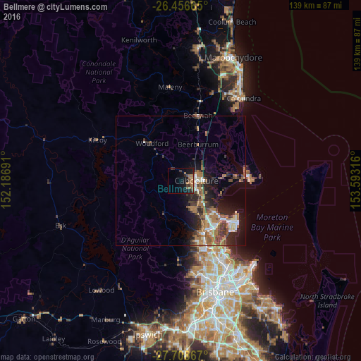
Analysis of Bellmere night lights 2016
Square area 10x10 km:
 0%
0%90-99
0%80-89
0.95%70-79
1.14%60-69
8.33%50-59
2.08%40-49
1.7%30-39
4.73%20-29
3.41%10-19
20.08%0-9
57.58%Square area 50x50 km:
1.03%90-99
1.15%80-89
0.83%70-79
0.53%60-69
4.33%50-59
1.4%40-49
1.69%30-39
2.31%20-29
2.91%10-19
6.18%0-9
77.63%Clear (daylight) street map image can be seen on geolist.org.
Map coordinates:
26° 27' 23.9" South, 152° 11' 12.9" East
27° 5' 3.9" South, 152° 53' 24.1" East
27° 42' 31.2" South, 153° 35' 35.4" East
Some cities around Bellmere sort by population:
• Caboolture
6 km =3.7 mi,  90°
90°
• North Lakes
20.2 km =12.6 mi,  140°
140°
• Morayfield
6.4 km =4 mi,  114°
114°
• Deception Bay
18.1 km =11.2 mi,  131°
131°
• Narangba
14.9 km =9.3 mi,  152°
152°
• Burpengary
10.5 km =6.5 mi, 140°
• Burpengary East
12.7 km =7.9 mi,  121°
121°
• Caboolture South
5.9 km =3.7 mi,  100°
100°
8348847 (p: 5,822)
Sources (retrieved 2019-11-25):
» Earth at Night: Flat Maps 2012, 2016