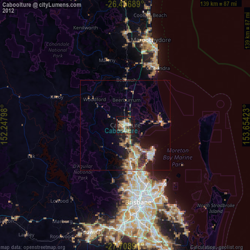
Caboolture night lights from space
Night Light of Caboolture (Queensland) from space (Australia) Src. Average luminocity for 10x10km area is 44.714% and for 50x50km: 11.0578%.
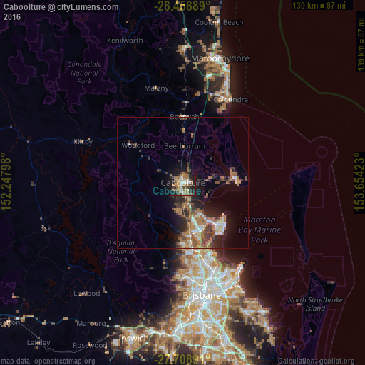
Analysis of Caboolture night lights 2016
Square area 10x10 km:
 4.73%
4.73%90-99
5.3%80-89
4.55%70-79
2.65%60-69
21.02%50-59
5.68%40-49
6.44%30-39
8.71%20-29
7.58%10-19
30.3%0-9
3.03%Square area 50x50 km:
1.04%90-99
1.24%80-89
0.87%70-79
0.56%60-69
4.5%50-59
1.53%40-49
1.78%30-39
2.35%20-29
2.92%10-19
6.28%0-9
76.94%Clear (daylight) street map image can be seen on geolist.org.
Map coordinates:
26° 27' 24.8" South, 152° 14' 52.7" East
27° 5' 4.7" South, 152° 57' 4" East
27° 42' 32.1" South, 153° 39' 15.2" East
Some cities around Caboolture sort by population:
• North Lakes
17 km =10.6 mi,  156°
156°
• Morayfield
2.7 km =1.7 mi,  184°
184°
• Deception Bay
14.2 km =8.8 mi,  148°
148°
• Narangba
13.2 km =8.2 mi, 176°
• Burpengary
8.1 km =5 mi, 175°
• Rothwell
17.2 km =10.7 mi, 146°
• Burpengary East
8.2 km =5.1 mi,  144°
144°
• Bellmere
6 km =3.7 mi,  270°
270°
2172832 (p: 26,341)
Sources (retrieved 2019-11-25):
» Earth at Night: Flat Maps 2012, 2016