Deception Bay night lights from space
Night Light of Deception Bay (Queensland) from space (Australia) Src. Average luminocity for 10x10km area is 48.8693% and for 50x50km: 19.4083%.
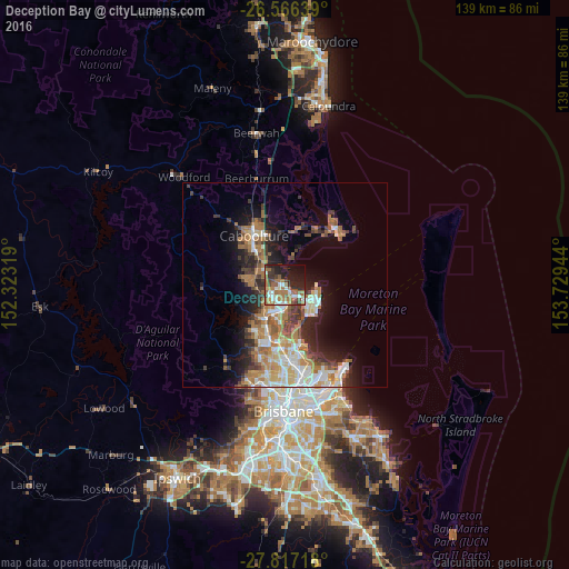
Analysis of Deception Bay night lights 2016
Square area 10x10 km:
 7.2%
7.2%90-99
8.52%80-89
1.7%70-79
3.22%60-69
23.67%50-59
5.3%40-49
6.25%30-39
6.44%20-29
14.58%10-19
17.42%0-9
5.68%Square area 50x50 km:
2.94%90-99
3.25%80-89
2.29%70-79
1.73%60-69
6.1%50-59
1.95%40-49
2.38%30-39
3%20-29
4.05%10-19
8.4%0-9
63.91%Clear (daylight) street map image can be seen on geolist.org.
Map coordinates:
26° 33' 59" South, 152° 19' 23.5" East
27° 11' 36.7" South, 153° 1' 34.7" East
27° 49' 1.8" South, 153° 43' 46" East
Some cities around Deception Bay sort by population:
• North Lakes
3.5 km =2.2 mi,  189°
189°
• Kallangur
7.3 km =4.5 mi,  207°
207°
• Narangba
6.7 km =4.2 mi,  260°
260°
• Burpengary
7.9 km =4.9 mi,  300°
300°
• Kippa-Ring
6.7 km =4.2 mi,  122°
122°
• Mango Hill
5.6 km =3.5 mi,  182°
182°
• Rothwell
3.1 km =1.9 mi,  138°
138°
• Burpengary East
6.1 km =3.8 mi,  334°
334°
2169220 (p: 19,539)
Sources (retrieved 2019-11-25):
» Earth at Night: Flat Maps 2012, 2016