Narangba night lights from space
Night Light of Narangba (Queensland) from space (Australia) Src. Average luminocity for 10x10km area is 41.0208% and for 50x50km: 20.2116%.
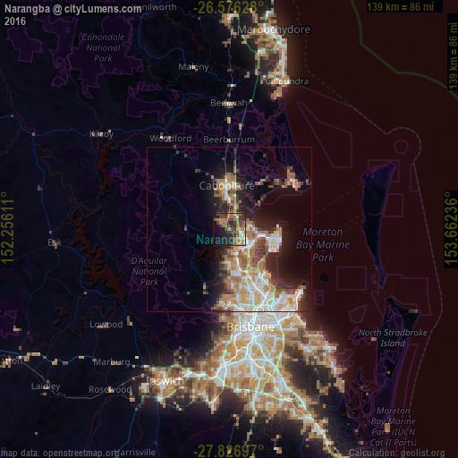
Analysis of Narangba night lights 2016
Square area 10x10 km:
 2.65%
2.65%90-99
4.36%80-89
0.95%70-79
3.03%60-69
22.54%50-59
3.79%40-49
7.77%30-39
14.96%20-29
12.31%10-19
16.29%0-9
11.36%Square area 50x50 km:
3.23%90-99
3.53%80-89
2.41%70-79
1.76%60-69
6.17%50-59
1.98%40-49
2.44%30-39
3.07%20-29
4.13%10-19
8.45%0-9
62.83%Clear (daylight) street map image can be seen on geolist.org.
Map coordinates:
26° 34' 34.6" South, 152° 15' 22" East
27° 12' 12.2" South, 152° 57' 33.2" East
27° 49' 37.1" South, 153° 39' 44.5" East
Some cities around Narangba sort by population:
• North Lakes
6.5 km =4 mi,  110°
110°
• Kallangur
6.3 km =3.9 mi,  148°
148°
• Deception Bay
6.7 km =4.2 mi,  80°
80°
• Burpengary
5.1 km =3.2 mi,  358°
358°
• Petrie
7.4 km =4.6 mi,  161°
161°
• Mango Hill
7.8 km =4.8 mi,  124°
124°
• Rothwell
8.7 km =5.4 mi,  98°
98°
• Burpengary East
7.7 km =4.8 mi,  31°
31°
2155787 (p: 18,217)
Sources (retrieved 2019-11-25):
» Earth at Night: Flat Maps 2012, 2016