Atwell night lights from space
Night Light of Atwell (Western Australia) from space (Australia) Src. Average luminocity for 10x10km area is 57.8094% and for 50x50km: 34.4666%.
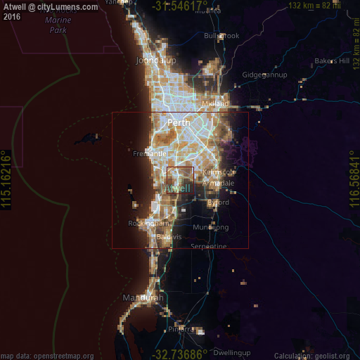
Analysis of Atwell night lights 2016
Square area 10x10 km:
 8.04%
8.04%90-99
7.17%80-89
4.9%70-79
8.92%60-69
18.36%50-59
14.51%40-49
11.89%30-39
8.57%20-29
12.06%10-19
5.59%0-9
0%Square area 50x50 km:
6.91%90-99
7.21%80-89
3.96%70-79
4.88%60-69
7.46%50-59
5.09%40-49
3.67%30-39
3.36%20-29
5.6%10-19
8.57%0-9
43.29%Clear (daylight) street map image can be seen on geolist.org.
Map coordinates:
31° 32' 46.2" South, 115° 9' 43.8" East
32° 8' 36.5" South, 115° 51' 55" East
32° 44' 12.7" South, 116° 34' 6.3" East
Some cities around Atwell sort by population:
• Leeming
7.6 km =4.7 mi,  0°
0°
• Success
1.4 km =0.9 mi,  272°
272°
• Piara Waters
4.9 km =3 mi,  76°
76°
• Yangebup
5.3 km =3.3 mi,  298°
298°
• Beeliar
5.7 km =3.5 mi,  281°
281°
• Aubin Grove
2.6 km =1.6 mi,  185°
185°
• South Lake
4.4 km =2.7 mi,  325°
325°
• Bibra Lake
6.7 km =4.2 mi,  319°
319°
8348275 (p: 8,926)
Sources (retrieved 2019-11-25):
» Earth at Night: Flat Maps 2012, 2016