Piara Waters night lights from space
Night Light of Piara Waters (Western Australia) from space (Australia) Src. Average luminocity for 10x10km area is 55.9161% and for 50x50km: 35.2609%.
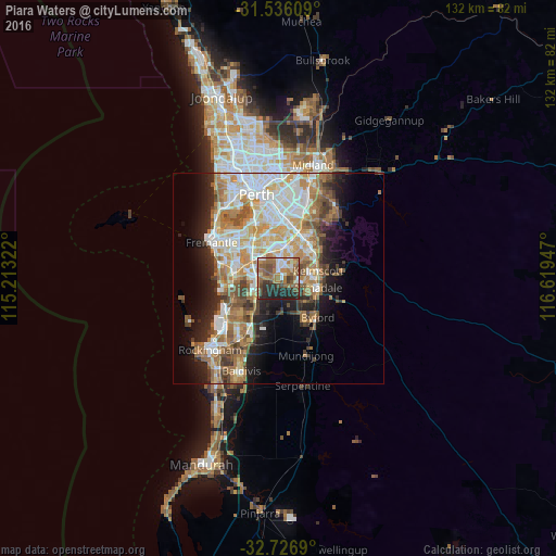
Analysis of Piara Waters night lights 2016
Square area 10x10 km:
 8.04%
8.04%90-99
7.52%80-89
3.32%70-79
4.72%60-69
20.8%50-59
17.31%40-49
9.44%30-39
5.77%20-29
18.01%10-19
5.07%0-9
0%Square area 50x50 km:
7.15%90-99
7.62%80-89
4%70-79
5.02%60-69
7.49%50-59
5.1%40-49
3.65%30-39
3.37%20-29
5.63%10-19
8.54%0-9
42.44%Clear (daylight) street map image can be seen on geolist.org.
Map coordinates:
31° 32' 9.9" South, 115° 12' 47.6" East
32° 8' 0.4" South, 115° 54' 58.8" East
32° 43' 36.8" South, 116° 37' 10.1" East
Some cities around Piara Waters sort by population:
• Southern River
5 km =3.1 mi,  53°
53°
• Seville Grove
6.9 km =4.3 mi,  92°
92°
• Success
6.3 km =3.9 mi,  260°
260°
• Atwell
4.9 km =3 mi, 256°
• Harrisdale
3.1 km =1.9 mi,  35°
35°
• Huntingdale
7.3 km =4.5 mi, 40°
• Aubin Grove
6.3 km =3.9 mi,  233°
233°
• South Lake
7.7 km =4.8 mi,  288°
288°
8348093 (p: 8,892)
Sources (retrieved 2019-11-25):
» Earth at Night: Flat Maps 2012, 2016