Haberfield night lights from space
Night Light of Haberfield (New South Wales) from space (Australia) Src. Average luminocity for 10x10km area is 92.8112% and for 50x50km: 48.8132%.
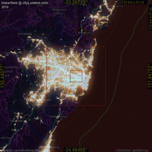
Analysis of Haberfield night lights 2016
Square area 10x10 km:
 43.88%
90-99
25.7%80-89
15.38%70-79
13.64%60-69
1.4%50-59
0%40-49
0%30-39
0%20-29
0%10-19
0%0-9
0%Square area 50x50 km:
11.8%90-99
12.71%80-89
6.74%70-79
7.63%60-69
8.45%50-59
4.29%40-49
2.72%30-39
3.7%20-29
5.45%10-19
9.04%0-9
27.46%Clear (daylight) street map image can be seen on geolist.org.
Map coordinates:
33° 17' 50.1" South, 150° 26' 26.8" East
33° 52' 58.7" South, 151° 8' 38" East
34° 27' 52.8" South, 151° 50' 49.3" East
Some cities around Haberfield sort by population:
• Ashfield
2 km =1.2 mi,  252°
252°
• Leichhardt
1.1 km =0.7 mi,  92°
92°
• Annandale
2.1 km =1.3 mi, 91°
• Five Dock
2.2 km =1.4 mi,  321°
321°
• Petersham
1.6 km =1 mi,  141°
141°
• Stanmore
2.2 km =1.4 mi,  123°
123°
• Lilyfield
2.2 km =1.4 mi,  65°
65°
• Summer Hill
1.1 km =0.7 mi,  208°
208°
2164123 (p: 6,363)
Sources (retrieved 2019-11-25):
» Earth at Night: Flat Maps 2012, 2016