Albany Creek night lights from space
Night Light of Albany Creek (Queensland) from space (Australia) Src. Average luminocity for 10x10km area is 63.3864% and for 50x50km: 33.7839%.
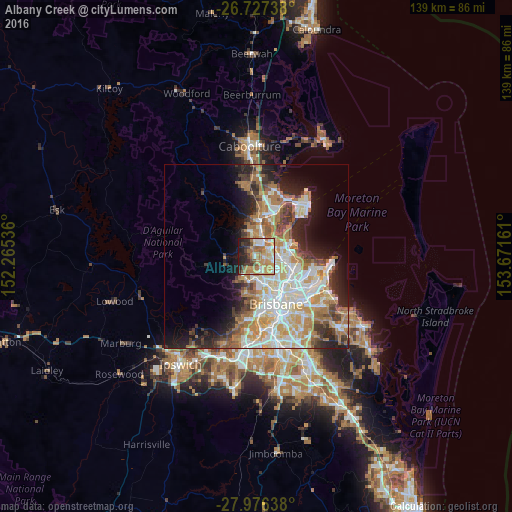
Analysis of Albany Creek night lights 2016
Square area 10x10 km:
 8.14%
8.14%90-99
9.09%80-89
12.69%70-79
14.2%60-69
20.27%50-59
5.68%40-49
6.25%30-39
7.2%20-29
10.42%10-19
6.06%0-9
0%Square area 50x50 km:
6.83%90-99
7.5%80-89
4.41%70-79
4.26%60-69
8.02%50-59
2.6%40-49
3.55%30-39
3.87%20-29
6%10-19
8.84%0-9
44.12%Clear (daylight) street map image can be seen on geolist.org.
Map coordinates:
26° 43' 38.6" South, 152° 15' 55.3" East
27° 21' 13.1" South, 152° 58' 6.5" East
27° 58' 35" South, 153° 40' 17.8" East
Some cities around Albany Creek sort by population:
• Aspley
5 km =3.1 mi,  106°
106°
• Warner
5 km =3.1 mi,  338°
338°
• Bridgeman Downs
2.6 km =1.6 mi,  94°
94°
• Eatons Hill
1.8 km =1.1 mi,  332°
332°
• McDowall
4 km =2.5 mi,  144°
144°
• Arana Hills
5 km =3.1 mi,  191°
191°
• Bald Hills
5.4 km =3.4 mi,  47°
47°
• Everton Hills
4 km =2.5 mi,  176°
176°
2178208 (p: 15,532)
Sources (retrieved 2019-11-25):
» Earth at Night: Flat Maps 2012, 2016