Aspley night lights from space
Night Light of Aspley (Queensland) from space (Australia) Src. Average luminocity for 10x10km area is 85.4375% and for 50x50km: 36.373%.
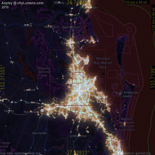
Analysis of Aspley night lights 2016
Square area 10x10 km:
 19.89%
90-99
24.05%80-89
23.86%70-79
16.29%60-69
12.31%50-59
3.22%40-49
0.38%30-39
0%20-29
0%10-19
0%0-9
0%Square area 50x50 km:
7.2%90-99
7.98%80-89
4.72%70-79
4.77%60-69
9.08%50-59
2.82%40-49
3.89%30-39
4.08%20-29
6.25%10-19
8.92%0-9
40.29%Clear (daylight) street map image can be seen on geolist.org.
Map coordinates:
26° 44' 25.7" South, 152° 18' 48.8" East
27° 22' 0" South, 153° 1' 0" East
27° 59' 21.6" South, 153° 43' 11.3" East
Some cities around Aspley sort by population:
• Chermside
2.4 km =1.5 mi,  145°
145°
• Carseldine
2.2 km =1.4 mi,  16°
16°
• Zillmere
3 km =1.9 mi,  66°
66°
• Bridgeman Downs
2.5 km =1.6 mi,  299°
299°
• McDowall
3 km =1.9 mi,  233°
233°
• Stafford Heights
3 km =1.9 mi,  191°
191°
• Chermside West
1.9 km =1.2 mi,  182°
182°
• Fitzgibbon
3.2 km =2 mi, 22°
2177546 (p: 12,000)
Sources (retrieved 2019-11-25):
» Earth at Night: Flat Maps 2012, 2016