Arana Hills night lights from space
Night Light of Arana Hills (Queensland) from space (Australia) Src. Average luminocity for 10x10km area is 60.8182% and for 50x50km: 38.9033%.
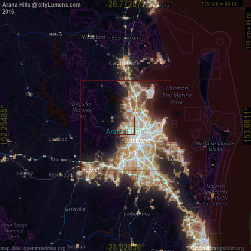
Analysis of Arana Hills night lights 2016
Square area 10x10 km:
 7.77%
7.77%90-99
10.8%80-89
11.17%70-79
11.74%60-69
17.99%50-59
4.73%40-49
9.47%30-39
5.3%20-29
8.71%10-19
12.31%0-9
0%Square area 50x50 km:
8.1%90-99
8.83%80-89
5.21%70-79
5.49%60-69
9.25%50-59
3.04%40-49
3.87%30-39
3.78%20-29
6.05%10-19
8.13%0-9
38.24%Clear (daylight) street map image can be seen on geolist.org.
Map coordinates:
26° 46' 19.5" South, 152° 15' 17.5" East
27° 23' 53.1" South, 152° 57' 28.7" East
28° 1' 14" South, 153° 39' 40" East
Some cities around Arana Hills sort by population:
• Everton Park
3.2 km =2 mi,  108°
108°
• Ferny Hills
2 km =1.2 mi,  276°
276°
• Mitchelton
2.2 km =1.4 mi,  157°
157°
• McDowall
3.8 km =2.4 mi,  62°
62°
• Keperra
2.1 km =1.3 mi,  211°
211°
• Everton Hills
1.6 km =1 mi,  52°
52°
• Ferny Grove
2.3 km =1.4 mi,  262°
262°
• Enoggera
3.7 km =2.3 mi,  153°
153°
9958149 (p: 6,672)
Sources (retrieved 2019-11-25):
» Earth at Night: Flat Maps 2012, 2016