Hohenems night lights from space
Night Light of Hohenems (Vorarlberg) from space (Austria) Src. Average luminocity for 10x10km area is 27.8676% and for 50x50km: 8.467%.
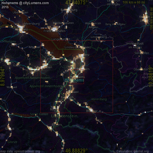
Analysis of Hohenems night lights 2016
Square area 10x10 km:
 1.04%
1.04%90-99
2.98%80-89
1.93%70-79
4.17%60-69
7.89%50-59
4.91%40-49
4.46%30-39
4.17%20-29
7.29%10-19
37.2%0-9
23.96%Square area 50x50 km:
0.46%90-99
1%80-89
0.73%70-79
1.03%60-69
1.36%50-59
1.53%40-49
1.7%30-39
1.26%20-29
2.14%10-19
8.54%0-9
80.25%Clear (daylight) street map image can be seen on geolist.org.
Map coordinates:
47° 50' 26.7" North, 8° 58' 47.8" East
47° 22' 0" North, 9° 40' 59" East
46° 53' 17.8" North, 10° 23' 10.3" East
Some cities around Hohenems sort by population:
• Dornbirn
6.9 km =4.3 mi,  39°
39°
• Lustenau
6.9 km =4.3 mi,  344°
344°
• Götzis
5.3 km =3.3 mi,  225°
225°
• Oberriet, CH
10 km =6.2 mi,  239°
239°
• Au, CH
8 km =5 mi,  332°
332°
• Altach
3.1 km =1.9 mi, 233°
• Diepoldsau, CH
3 km =1.9 mi,  316°
316°
• Sankt Margrethen, CH
10.1 km =6.3 mi, 340°
2775742 (p: 16,317)
Sources (retrieved 2019-11-25):
» Earth at Night: Flat Maps 2012, 2016