Sankt Margrethen night lights from space
Night Light of Sankt Margrethen (Saint Gallen) from space (Switzerland) Src. Average luminocity for 10x10km area is 29.1108% and for 50x50km: 8.2611%.
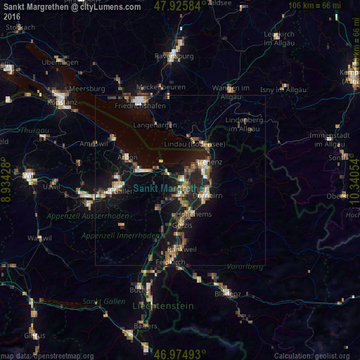
Analysis of Sankt Margrethen night lights 2016
Square area 10x10 km:
 0.43%
0.43%90-99
3.55%80-89
1.7%70-79
3.98%60-69
5.11%50-59
6.68%40-49
9.09%30-39
5.54%20-29
13.78%10-19
25.14%0-9
25%Square area 50x50 km:
0.56%90-99
1%80-89
0.68%70-79
0.89%60-69
1.33%50-59
1.4%40-49
1.68%30-39
1.21%20-29
2.11%10-19
8.76%0-9
80.38%Clear (daylight) street map image can be seen on geolist.org.
Map coordinates:
47° 55' 33" North, 8° 56' 3.4" East
47° 27' 9.1" North, 9° 38' 14.7" East
46° 58' 29.7" North, 10° 20' 25.9" East
Some cities around Sankt Margrethen sort by population:
• Lustenau, AT
3.3 km =2.1 mi,  151°
151°
• Hard, AT
4.8 km =3 mi,  45°
45°
• Lauterach, AT
7.4 km =4.6 mi,  69°
69°
• Wolfurt, AT
8.6 km =5.3 mi,  79°
79°
• Höchst, AT
0.8 km =0.5 mi,  17°
17°
• Au
2.4 km =1.5 mi,  185°
185°
• Thal
5.6 km =3.5 mi,  286°
286°
• Diepoldsau
7.5 km =4.7 mi,  169°
169°
2658816 (p: 5,395)
Sources (retrieved 2019-11-25):
» Earth at Night: Flat Maps 2012, 2016