Villa La Angostura night lights from space
Night Light of Villa La Angostura (Neuquen) from space (Argentina) Src. Average luminocity for 10x10km area is 8.9286% and for 50x50km: 0.3746%.
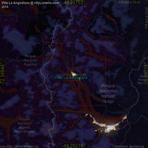
Analysis of Villa La Angostura night lights 2016
Square area 10x10 km:
 0%
0%90-99
1.46%80-89
1.95%70-79
1.79%60-69
0.65%50-59
1.95%40-49
0.16%30-39
1.46%20-29
2.27%10-19
1.79%0-9
86.53%Square area 50x50 km:
0%90-99
0.06%80-89
0.08%70-79
0.07%60-69
0.03%50-59
0.08%40-49
0.01%30-39
0.06%20-29
0.1%10-19
0.08%0-9
99.43%Clear (daylight) street map image can be seen on geolist.org.
Map coordinates:
40° 13' 37.3" South, 72° 20' 58" West
40° 45' 42.2" South, 71° 38' 46.7" West
41° 17' 31.8" South, 70° 56' 35.5" West
Some cities around Villa La Angostura sort by population:
• Osorno, CL
127.1 km =79 mi,  279°
279°
• San Carlos de Bariloche
51.3 km =31.9 mi,  146°
146°
• La Unión, CL
132 km =82 mi,  293°
293°
• Puerto Varas, CL
128.3 km =79.7 mi,  241°
241°
• San Martín de los Andes
71.6 km =44.5 mi,  20°
20°
• Río Bueno, CL
120.4 km =74.8 mi, 293°
• Purranque, CL
128.4 km =79.8 mi,  262°
262°
• Junín de los Andes
102.6 km =63.8 mi,  28°
28°
3832711 (p: 7,526)
Sources (retrieved 2019-11-25):
» Earth at Night: Flat Maps 2012, 2016