Villa Gesell night lights from space
Night Light of Villa Gesell (Buenos Aires) from space (Argentina) Src. Average luminocity for 10x10km area is 26.1463% and for 50x50km: 3.5555%.
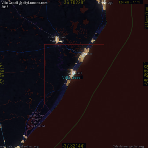
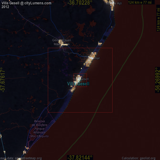
Analysis of Villa Gesell night lights 2016
Square area 10x10 km:
 2.89%
2.89%90-99
5.1%80-89
4.08%70-79
3.23%60-69
3.91%50-59
3.74%40-49
3.57%30-39
0.68%20-29
1.19%10-19
33.67%0-9
37.93%Square area 50x50 km:
0.2%90-99
0.42%80-89
0.63%70-79
0.63%60-69
0.57%50-59
0.41%40-49
0.36%30-39
0.2%20-29
0.36%10-19
3.72%0-9
92.49%Clear (daylight) street map image can be seen on geolist.org.
Map coordinates:
36° 42' 8.2" South, 57° 40' 34.2" West
37° 15' 50.2" South, 56° 58' 22.9" West
37° 49' 17.2" South, 56° 16' 11.7" West
Some cities around Villa Gesell sort by population:
• Montevideo, UY
271.8 km =168.9 mi,  15°
15°
• Mar del Plata
96.7 km =60.1 mi,  212°
212°
• Tandil
191.2 km =118.8 mi,  268°
268°
• Necochea
211.2 km =131.2 mi,  227°
227°
• Azul
261.8 km =162.7 mi,  281°
281°
• Balcarce
130.2 km =80.9 mi,  240°
240°
• Dolores
123 km =76.4 mi,  329°
329°
• San Clemente del Tuyú
103.3 km =64.2 mi,  12°
12°
3427431 (p: 23,257)
Sources (retrieved 2019-11-25):
» Earth at Night: Flat Maps 2012, 2016