Suncho Corral night lights from space
Night Light of Suncho Corral (Santiago del Estero) from space (Argentina) Src. Average luminocity for 10x10km area is 5.4945% and for 50x50km: 0.3589%.
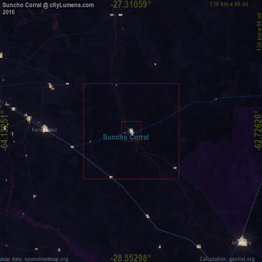
Analysis of Suncho Corral night lights 2016
Square area 10x10 km:
 0%
0%90-99
1.64%80-89
1.27%70-79
0%60-69
0.73%50-59
0.73%40-49
0.73%30-39
1.45%20-29
1.45%10-19
0%0-9
92%Square area 50x50 km:
0%90-99
0.07%80-89
0.08%70-79
0.02%60-69
0.08%50-59
0.06%40-49
0.06%30-39
0.11%20-29
0.07%10-19
0.01%0-9
99.45%Clear (daylight) street map image can be seen on geolist.org.
Map coordinates:
27° 18' 38.1" South, 64° 7' 57" West
27° 56' 0.9" South, 63° 25' 45.8" West
28° 33' 10.7" South, 62° 43' 34.5" West
Some cities around Suncho Corral sort by population:
• Santiago del Estero
83.2 km =51.7 mi,  280°
280°
• Termas de Río Hondo
149 km =92.6 mi,  289°
289°
• Añatuya
82.6 km =51.3 mi,  135°
135°
• Quimilí
104.6 km =65 mi,  72°
72°
• Clodomira
79.8 km =49.6 mi,  300°
300°
• Villa Ojo de Agua
176.1 km =109.4 mi,  188°
188°
• Campo Gallo
160.7 km =99.9 mi,  20°
20°
• Beltrán
63.2 km =39.3 mi, 280°
3834961 (p: 6,087)
Sources (retrieved 2019-11-25):
» Earth at Night: Flat Maps 2012, 2016