Las Heras night lights from space
Night Light of Las Heras (Santa Cruz) from space (Argentina) Src. Average luminocity for 10x10km area is 16.4091% and for 50x50km: 0.8735%.
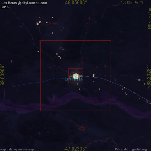
Analysis of Las Heras night lights 2016
Square area 10x10 km:
 2.56%
2.56%90-99
3.13%80-89
0.57%70-79
2.41%60-69
2.84%50-59
1.99%40-49
1.28%30-39
0.85%20-29
1.7%10-19
10.94%0-9
71.73%Square area 50x50 km:
0.11%90-99
0.13%80-89
0.05%70-79
0.1%60-69
0.16%50-59
0.09%40-49
0.16%30-39
0.09%20-29
0.1%10-19
0.49%0-9
98.52%Clear (daylight) street map image can be seen on geolist.org.
Map coordinates:
46° 3' 21.9" South, 69° 38' 20.6" West
46° 32' 30.7" South, 68° 56' 9.3" West
47° 1' 24" South, 68° 13' 58.1" West
Some cities around Las Heras sort by population:
• Comodoro Rivadavia
134 km =83.3 mi,  55°
55°
• Coyhaique, CL
264.3 km =164.2 mi,  293°
293°
• Caleta Olivia
108.4 km =67.4 mi,  83°
83°
• Puerto Aysén, CL
316.6 km =196.7 mi, 293°
• Pico Truncado
79.8 km =49.6 mi,  110°
110°
• Puerto Deseado
266.4 km =165.5 mi,  120°
120°
• Sarmiento
106.5 km =66.2 mi,  354°
354°
• Rada Tilly
126.5 km =78.6 mi, 57°
3848353 (p: 9,303)
Sources (retrieved 2019-11-25):
» Earth at Night: Flat Maps 2012, 2016