Pico Truncado night lights from space
Night Light of Pico Truncado (Santa Cruz) from space (Argentina) Src. Average luminocity for 10x10km area is 17.4241% and for 50x50km: 1.0559%.
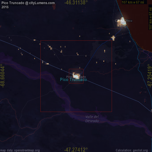
Analysis of Pico Truncado night lights 2016
Square area 10x10 km:
 3.72%
3.72%90-99
2.83%80-89
0.6%70-79
2.23%60-69
2.53%50-59
2.98%40-49
1.19%30-39
0.45%20-29
1.34%10-19
11.46%0-9
70.68%Square area 50x50 km:
0.15%90-99
0.11%80-89
0.02%70-79
0.14%60-69
0.22%50-59
0.17%40-49
0.14%30-39
0.27%20-29
0.12%10-19
0.53%0-9
98.15%Clear (daylight) street map image can be seen on geolist.org.
Map coordinates:
46° 18' 41" South, 68° 39' 37.6" West
46° 47' 41.6" South, 67° 57' 26.3" West
47° 16' 26.8" South, 67° 15' 15.1" West
Some cities around Pico Truncado sort by population:
• Comodoro Rivadavia
109.4 km =68 mi,  18°
18°
• Coyhaique, CL
344.1 km =213.8 mi,  293°
293°
• Caleta Olivia
51.4 km =31.9 mi,  39°
39°
• Puerto Deseado
188.5 km =117.1 mi,  124°
124°
• Las Heras
79.8 km =49.6 mi, 290°
• Sarmiento
159.2 km =98.9 mi,  327°
327°
• Rada Tilly
101.6 km =63.1 mi, 17°
• San Julián
279.7 km =173.8 mi,  176°
176°
3841309 (p: 14,985)
Sources (retrieved 2019-11-25):
» Earth at Night: Flat Maps 2012, 2016