Zaranj night lights from space
Night Light of Zaranj (Nimroz) from space (Afghanistan) Src. Average luminocity for 10x10km area is 30.1923% and for 50x50km: 5.6704%.
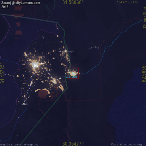
Analysis of Zaranj night lights 2016
Square area 10x10 km:
 0.73%
0.73%90-99
3.3%80-89
4.76%70-79
9.89%60-69
4.4%50-59
1.83%40-49
5.31%30-39
6.04%20-29
2.56%10-19
34.8%0-9
26.37%Square area 50x50 km:
0.16%90-99
0.24%80-89
0.36%70-79
1.1%60-69
1.21%50-59
0.65%40-49
1.17%30-39
1.4%20-29
1.65%10-19
4.38%0-9
87.69%Clear (daylight) street map image can be seen on geolist.org.
Map coordinates:
31° 33' 38.4" North, 61° 9' 26.1" East
30° 57' 34.6" North, 61° 51' 37.3" East
30° 21' 17.2" North, 62° 33' 48.6" East
Some cities around Zaranj sort by population:
• Zahedan, IR
188.8 km =117.3 mi,  210°
210°
• Zābol, IR
35.7 km =22.2 mi,  282°
282°
• Farah
159.2 km =98.9 mi,  8°
8°
• Khāsh
108.8 km =67.6 mi,  54°
54°
• Mīrābād
58.2 km =36.2 mi,  182°
182°
• Rūdbār
114.5 km =71.1 mi,  141°
141°
• Anār Darah
201 km =124.9 mi,  354°
354°
• ‘Alāqahdārī Dīshū
149.4 km =92.8 mi,  113°
113°
1120985 (p: 49,851)
Sources (retrieved 2019-11-25):
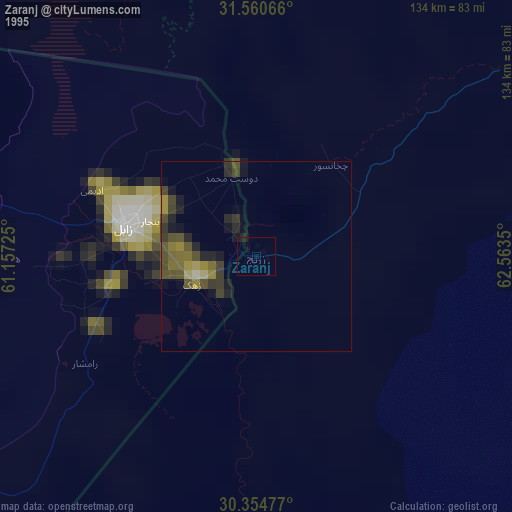
» NASA, Earths city lights 1995
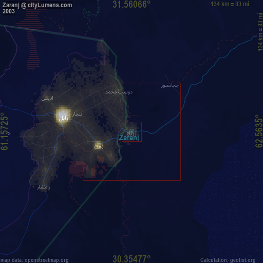
» NASA city lights 2003
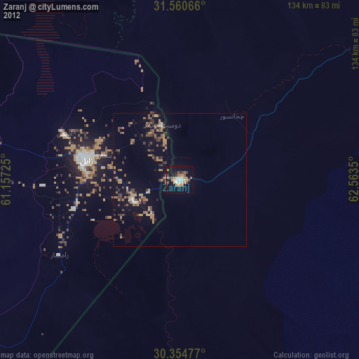
» Earth at Night: Flat Maps 2012, 2016