Mehtar Lām night lights from space
Night Light of Mehtar Lām (Laghman) from space (Afghanistan) Src. Average luminocity for 10x10km area is 4.6836% and for 50x50km: 0.7155%.
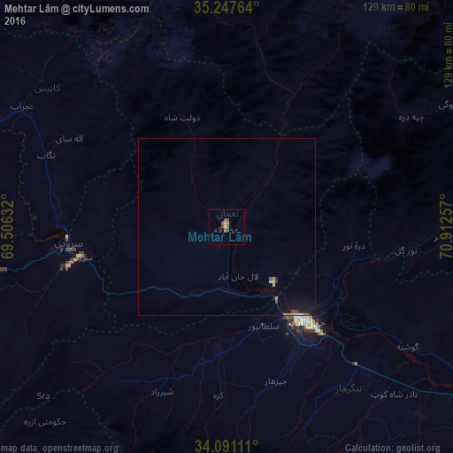
Analysis of Mehtar Lām night lights 2016
Square area 10x10 km:
 0%
0%90-99
0%80-89
1.4%70-79
0%60-69
0.87%50-59
2.1%40-49
2.45%30-39
0.17%20-29
0%10-19
0%0-9
93.01%Square area 50x50 km:
0%90-99
0.06%80-89
0.13%70-79
0.12%60-69
0.04%50-59
0.14%40-49
0.18%30-39
0.05%20-29
0.08%10-19
0.8%0-9
98.41%Clear (daylight) street map image can be seen on geolist.org.
Map coordinates:
35° 14' 51.5" North, 69° 30' 22.8" East
34° 40' 17" North, 70° 12' 34" East
34° 5' 28" North, 70° 54' 45.3" East
Some cities around Mehtar Lām sort by population:
• Jalālābād
35.1 km =21.8 mi,  140°
140°
• Asadābād
88.5 km =55 mi,  75°
75°
• Markaz-e Woluswalī-ye Āchīn
76 km =47.2 mi, 142°
• Ḩukūmatī Azrah
75.7 km =47 mi,  223°
223°
• Sidqābād
87.5 km =54.4 mi,  296°
296°
• Bāsawul
76.9 km =47.8 mi,  127°
127°
• Tagāb
55.1 km =34.2 mi,  291°
291°
• Parachinar, PK
86.4 km =53.7 mi,  186°
186°
1133574 (p: 17,345)
Sources (retrieved 2019-11-25):
» Earth at Night: Flat Maps 2012, 2016