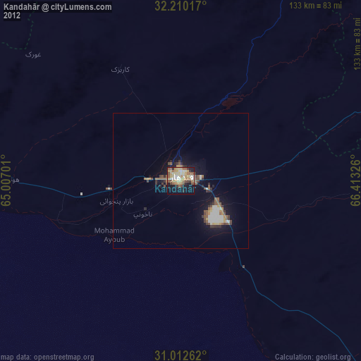
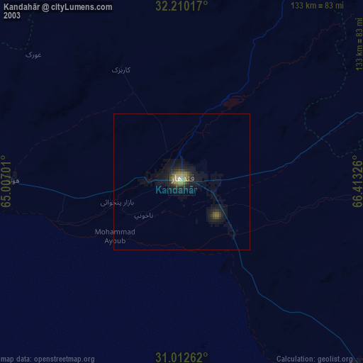
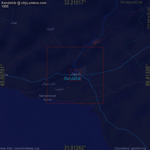
Kandahār night lights from space
Night Light of Kandahār (Kandahar) from space (Afghanistan) Src. Average luminocity for 10x10km area is 25.685% and for 50x50km: 3.2608%.
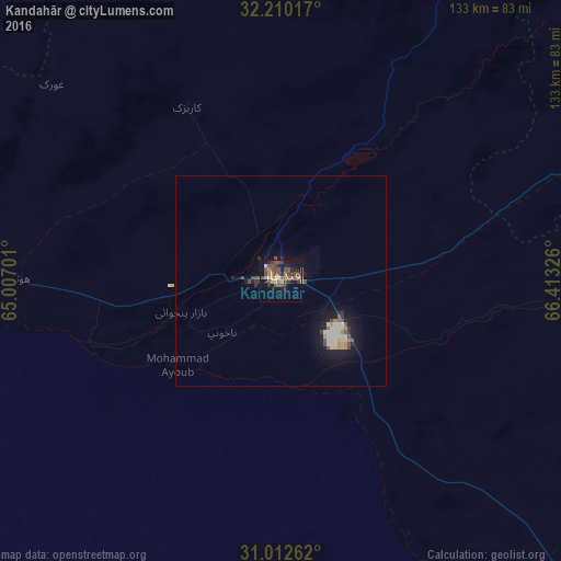
Analysis of Kandahār night lights 2016
Square area 10x10 km:
 0%
0%90-99
0.73%80-89
0.73%70-79
4.58%60-69
5.31%50-59
7.33%40-49
13%30-39
6.96%20-29
3.11%10-19
16.85%0-9
41.39%Square area 50x50 km:
0.25%90-99
0.39%80-89
0.33%70-79
0.4%60-69
0.38%50-59
0.47%40-49
0.93%30-39
0.47%20-29
0.41%10-19
2.97%0-9
93.01%Clear (daylight) street map image can be seen on geolist.org.
Map coordinates:
32° 12' 36.6" North, 65° 0' 25.2" East
31° 36' 48" North, 65° 42' 36.5" East
31° 0' 45.4" North, 66° 24' 47.7" East
Some cities around Kandahār sort by population:
• Chaman, PK
104.7 km =65.1 mi,  137°
137°
• Lashkar Gāh
126.8 km =78.8 mi,  269°
269°
• Gereshk
110.3 km =68.5 mi,  282°
282°
• Pishin, PK
167.6 km =104.1 mi,  133°
133°
• Sangīn
97.1 km =60.3 mi,  301°
301°
• Qalāt
125.7 km =78.1 mi,  64°
64°
• Tarinkot
114.1 km =70.9 mi,  7°
7°
• Markaz-e Ḩukūmat-e Darwēshān
153.6 km =95.4 mi,  249°
249°
1138336 (p: 391,190)
Sources (retrieved 2019-11-25):
» NASA, Earths city lights 1995
» NASA city lights 2003
» Earth at Night: Flat Maps 2012, 2016