Pishin night lights from space
Night Light of Pishin (Balochistan) from space (Pakistan) Src. Average luminocity for 10x10km area is 0.1355% and for 50x50km: 0.1861%.
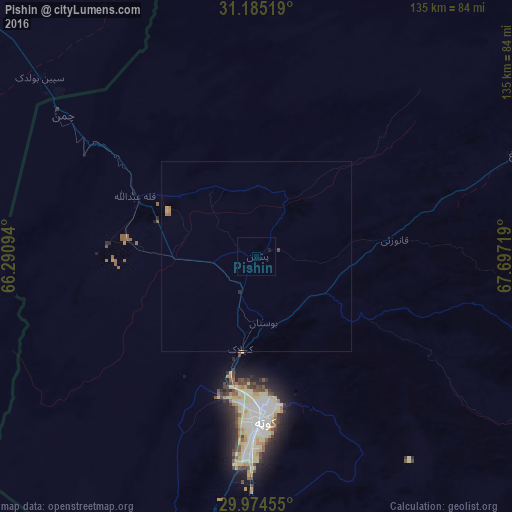
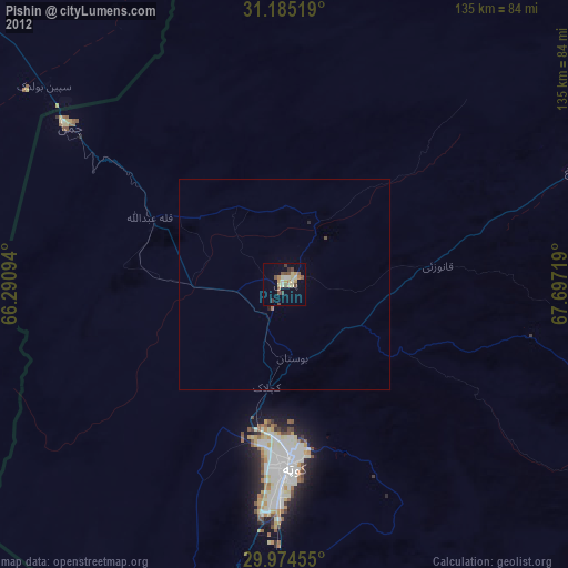
Analysis of Pishin night lights 2016
Square area 10x10 km:
 0%
0%90-99
0%80-89
0%70-79
0%60-69
0%50-59
0%40-49
0%30-39
0%20-29
0%10-19
0.73%0-9
99.27%Square area 50x50 km:
0%90-99
0%80-89
0.01%70-79
0.08%60-69
0.08%50-59
0.01%40-49
0.04%30-39
0.01%20-29
0.03%10-19
0.05%0-9
99.69%Clear (daylight) street map image can be seen on geolist.org.
Map coordinates:
31° 11' 6.7" North, 66° 17' 27.4" East
30° 34' 54.3" North, 66° 59' 38.6" East
29° 58' 28.4" North, 67° 41' 49.9" East
Some cities around Pishin sort by population:
• Quetta
44.2 km =27.5 mi,  179°
179°
• Chaman
63.8 km =39.6 mi,  305°
305°
• Kot Malik Barkhurdar
42 km =26.1 mi, 180°
• Mastung
88.1 km =54.7 mi,  189°
189°
• Mach
86.1 km =53.5 mi,  157°
157°
• Harnai
105.2 km =65.4 mi,  120°
120°
• Alik Ghund
51.6 km =32.1 mi,  101°
101°
• Khadan Khak
71.2 km =44.2 mi,  74°
74°
1167821 (p: 24,239)
Sources (retrieved 2019-11-25):
» Earth at Night: Flat Maps 2012, 2016