Kadoma night lights from space
Night Light of Kadoma (Mashonaland West) from space (Zimbabwe) Src. Average luminocity for 10x10km area is 17.5806% and for 50x50km: 1.5201%.
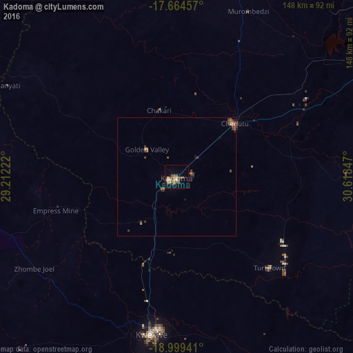

Analysis of Kadoma night lights 2016
Square area 10x10 km:
 1.24%
1.24%90-99
1.24%80-89
0.83%70-79
3.31%60-69
3.93%50-59
4.55%40-49
5.58%30-39
0.21%20-29
3.1%10-19
2.48%0-9
73.55%Square area 50x50 km:
0.05%90-99
0.05%80-89
0.04%70-79
0.27%60-69
0.38%50-59
0.36%40-49
0.5%30-39
0.37%20-29
0.28%10-19
0.23%0-9
97.47%Clear (daylight) street map image can be seen on geolist.org.
Map coordinates:
17° 39' 52.5" South, 29° 12' 44" East
18° 19' 59.8" South, 29° 54' 55.2" East
18° 59' 57.9" South, 30° 37' 6.5" East
Some cities around Kadoma sort by population:
• Kwekwe
67 km =41.6 mi,  189°
189°
• Chinhoyi
111.6 km =69.3 mi,  15°
15°
• Norton
96.8 km =60.1 mi,  58°
58°
• Chegutu
32.8 km =20.4 mi,  46°
46°
• Redcliff
79.1 km =49.2 mi, 190°
• Gokwe
104.5 km =64.9 mi,  277°
277°
• Banket
117.4 km =72.9 mi,  25°
25°
• Chakari
30.2 km =18.8 mi,  355°
355°
889453 (p: 79,174)
Sources (retrieved 2019-11-25):
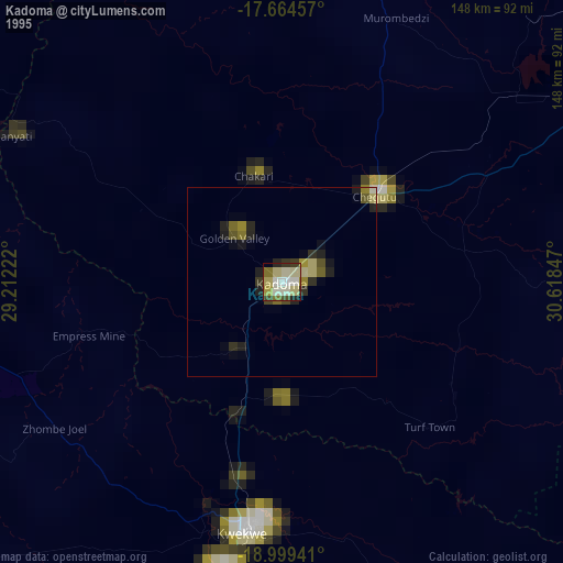
» NASA, Earths city lights 1995
» NASA city lights 2003
» Earth at Night: Flat Maps 2012, 2016