Mpulungu night lights from space
Night Light of Mpulungu (Northern) from space (Zambia) Src. Average luminocity for 10x10km area is 7.2851% and for 50x50km: 0.4181%.
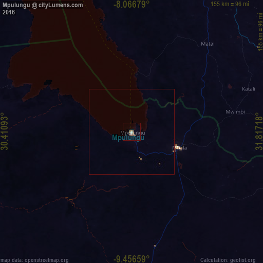
Analysis of Mpulungu night lights 2016
Square area 10x10 km:
 1.03%
1.03%90-99
0.62%80-89
0%70-79
1.03%60-69
1.86%50-59
2.07%40-49
0.83%30-39
2.48%20-29
0.83%10-19
0%0-9
89.26%Square area 50x50 km:
0.04%90-99
0.03%80-89
0%70-79
0.04%60-69
0.14%50-59
0.09%40-49
0.09%30-39
0.1%20-29
0.03%10-19
0%0-9
99.43%Clear (daylight) street map image can be seen on geolist.org.
Map coordinates:
8° 4' 0.4" South, 30° 24' 39.3" East
8° 45' 44.4" South, 31° 6' 50.6" East
9° 27' 23.7" South, 31° 49' 1.8" East
Some cities around Mpulungu sort by population:
• Sumbawanga, TZ
104.3 km =64.8 mi,  32°
32°
• Namanyere, TZ
138.7 km =86.2 mi,  357°
357°
• Matai, TZ
67.8 km =42.1 mi,  40°
40°
• Chala, TZ
132.2 km =82.1 mi,  7°
7°
• Mbala
29 km =18 mi,  107°
107°
• Laela, TZ
105.2 km =65.4 mi,  78°
78°
• Mungwi
159.4 km =99 mi,  169°
169°
• Nkove, TZ
94.9 km =59 mi,  342°
342°
175961 (p: 8,547)
Sources (retrieved 2019-11-25):
» Earth at Night: Flat Maps 2012, 2016