Lusaka night lights from space
Night Light of Lusaka from space (Zambia) Src. Average luminocity for 10x10km area is 99.6061% and for 50x50km: 26.3277%.
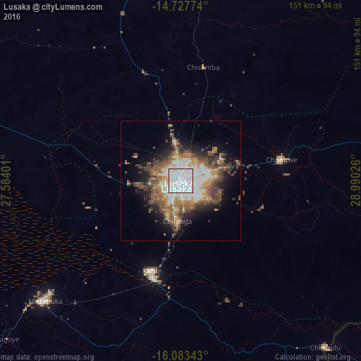
Analysis of Lusaka night lights 2016
Square area 10x10 km:
 81.82%
90-99
17.1%80-89
1.08%70-79
0%60-69
0%50-59
0%40-49
0%30-39
0%20-29
0%10-19
0%0-9
0%Square area 50x50 km:
6.12%90-99
4.37%80-89
2.32%70-79
3.35%60-69
3.63%50-59
4.66%40-49
5.2%30-39
3.76%20-29
4.05%10-19
8.49%0-9
54.04%Clear (daylight) street map image can be seen on geolist.org.
Map coordinates:
14° 43' 39.9" South, 27° 35' 2.4" East
15° 24' 24.1" South, 28° 17' 13.7" East
16° 5' 0.3" South, 28° 59' 24.9" East
Some cities around Lusaka sort by population:
• Kabwe
108.1 km =67.2 mi,  9°
9°
• Mazabuka
76.3 km =47.4 mi,  229°
229°
• Kafue
41.9 km =26 mi,  195°
195°
• Monze
130 km =80.8 mi,  221°
221°
• Kariba, ZW
135 km =83.9 mi,  156°
156°
• Siavonga
133.6 km =83 mi, 160°
• Nakambala
72 km =44.7 mi, 228°
• Chongwe
43.2 km =26.8 mi,  78°
78°
909137 (p: 1,267,440)
Sources (retrieved 2019-11-25):
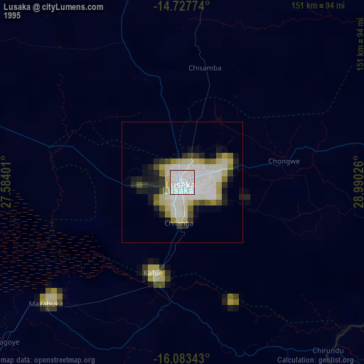
» NASA, Earths city lights 1995
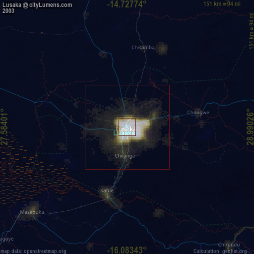
» NASA city lights 2003
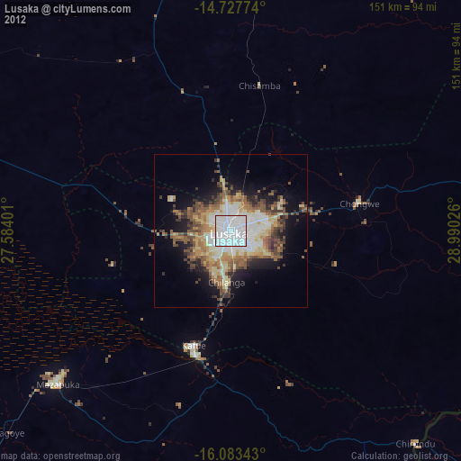
» Earth at Night: Flat Maps 2012, 2016