Witbank night lights from space
Night Light of Witbank (Mpumalanga) from space (South Africa) Src. Average luminocity for 10x10km area is 71.9223% and for 50x50km: 19.8371%.
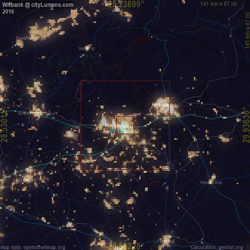
Analysis of Witbank night lights 2016
Square area 10x10 km:
 10.04%
90-99
11.36%80-89
13.45%70-79
28.22%60-69
12.88%50-59
7.2%40-49
9.28%30-39
4.73%20-29
2.65%10-19
0.19%0-9
0%Square area 50x50 km:
1.23%90-99
1.56%80-89
2.92%70-79
4.27%60-69
3.46%50-59
1.84%40-49
3.78%30-39
4.05%20-29
5.13%10-19
18.65%0-9
53.1%Clear (daylight) street map image can be seen on geolist.org.
Map coordinates:
25° 14' 13.2" South, 28° 31' 48.4" East
25° 52' 16.8" South, 29° 13' 59.6" East
26° 30' 8.2" South, 29° 56' 10.9" East
Some cities around Witbank sort by population:
• Middelburg
25.5 km =15.8 mi,  65°
65°
• Bethal
69.2 km =43 mi,  160°
160°
• Delmas
62.9 km =39.1 mi,  240°
240°
• Ekangala
52.2 km =32.4 mi,  291°
291°
• Bronkhorstspruit
49.6 km =30.8 mi,  277°
277°
• Cullinan
74.5 km =46.3 mi, 287°
• Hendrina
57.8 km =35.9 mi,  123°
123°
• Kriel
44.8 km =27.8 mi,  181°
181°
939270 (p: 262,491)
Sources (retrieved 2019-11-25):
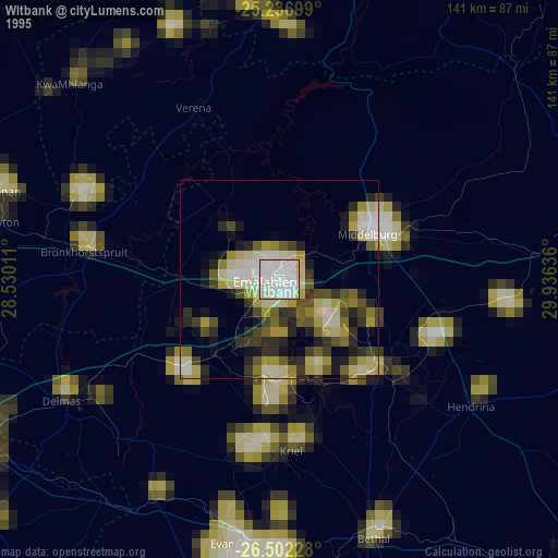
» NASA, Earths city lights 1995
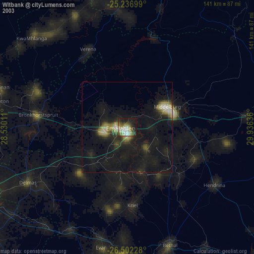
» NASA city lights 2003
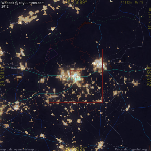
» Earth at Night: Flat Maps 2012, 2016