Delmas night lights from space
Night Light of Delmas (Mpumalanga) from space (South Africa) Src. Average luminocity for 10x10km area is 36.8631% and for 50x50km: 14.8538%.
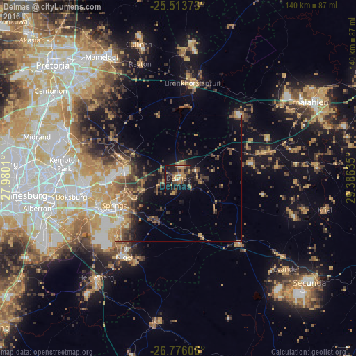
Analysis of Delmas night lights 2016
Square area 10x10 km:
 2.18%
2.18%90-99
1.39%80-89
3.37%70-79
8.53%60-69
10.32%50-59
3.97%40-49
8.93%30-39
8.53%20-29
8.13%10-19
42.26%0-9
2.38%Square area 50x50 km:
0.93%90-99
1.11%80-89
1.62%70-79
2.81%60-69
2.77%50-59
2.28%40-49
4.2%30-39
3.43%20-29
3.75%10-19
8.92%0-9
68.19%Clear (daylight) street map image can be seen on geolist.org.
Map coordinates:
25° 30' 49.4" South, 27° 58' 48.4" East
26° 8' 47.8" South, 28° 40' 59.6" East
26° 46' 33.8" South, 29° 23' 10.9" East
Some cities around Delmas sort by population:
• Benoni
36.5 km =22.7 mi,  262°
262°
• Tembisa
48.5 km =30.1 mi,  290°
290°
• Boksburg
42.9 km =26.7 mi, 260°
• Brakpan
32.9 km =20.4 mi,  252°
252°
• Springs
30.5 km =19 mi, 247°
• Nigel
37.7 km =23.4 mi,  212°
212°
• Ekangala
50.5 km =31.4 mi,  7°
7°
• Bronkhorstspruit
37.9 km =23.5 mi, 8°
1011031 (p: 92,046)
Sources (retrieved 2019-11-25):
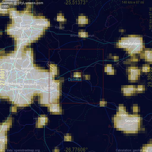
» NASA, Earths city lights 1995
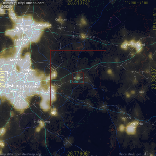
» NASA city lights 2003
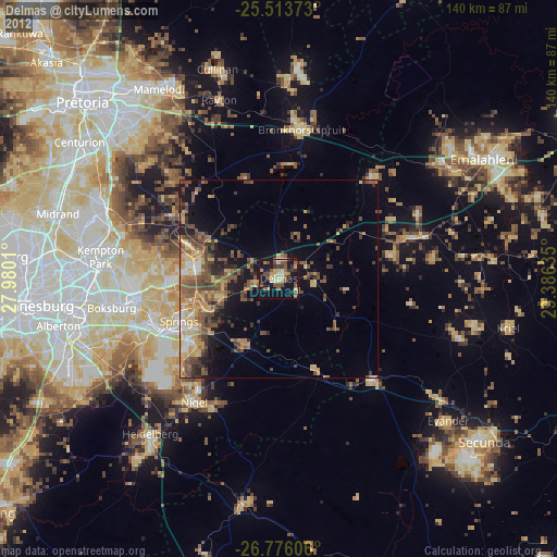
» Earth at Night: Flat Maps 2012, 2016