Ekangala night lights from space
Night Light of Ekangala (Gauteng) from space (South Africa) Src. Average luminocity for 10x10km area is 28.6894% and for 50x50km: 7.1654%.
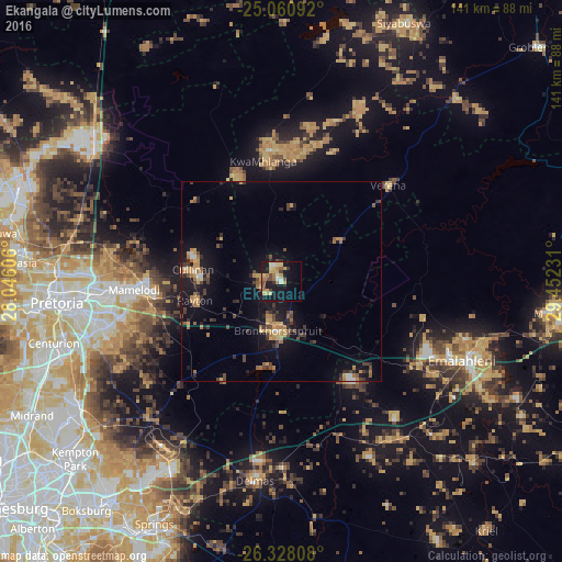
Analysis of Ekangala night lights 2016
Square area 10x10 km:
 1.14%
1.14%90-99
3.22%80-89
6.44%70-79
6.44%60-69
5.49%50-59
2.08%40-49
4.92%30-39
2.27%20-29
2.08%10-19
33.33%0-9
32.58%Square area 50x50 km:
0.25%90-99
0.38%80-89
0.85%70-79
1.48%60-69
1.33%50-59
0.66%40-49
1.54%30-39
1.26%20-29
1.51%10-19
7.2%0-9
83.55%Clear (daylight) street map image can be seen on geolist.org.
Map coordinates:
25° 3' 39.3" South, 28° 2' 45.8" East
25° 41' 46.3" South, 28° 44' 57" East
26° 19' 41.1" South, 29° 27' 8.3" East
Some cities around Ekangala sort by population:
• Pretoria
56.5 km =35.1 mi,  264°
264°
• Tembisa
62 km =38.5 mi,  237°
237°
• Witbank
52.2 km =32.4 mi,  111°
111°
• Centurion
59.2 km =36.8 mi,  252°
252°
• Delmas
50.5 km =31.4 mi,  187°
187°
• Bronkhorstspruit
12.7 km =7.9 mi,  183°
183°
• Cullinan
22.8 km =14.2 mi,  277°
277°
• Midstream
60.4 km =37.5 mi, 245°
1105726 (p: 37,650)
Sources (retrieved 2019-11-25):
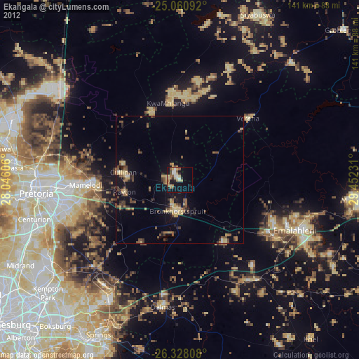
» Earth at Night: Flat Maps 2012, 2016