Warmbaths night lights from space
Night Light of Warmbaths (Limpopo) from space (South Africa) Src. Average luminocity for 10x10km area is 16.7765% and for 50x50km: 2.4927%.
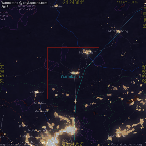
Analysis of Warmbaths night lights 2016
Square area 10x10 km:
 0%
0%90-99
0.76%80-89
4.73%70-79
7.2%60-69
2.08%50-59
0%40-49
0.76%30-39
2.84%20-29
2.46%10-19
3.22%0-9
75.95%Square area 50x50 km:
0%90-99
0.09%80-89
0.43%70-79
0.71%60-69
0.53%50-59
0.29%40-49
0.49%30-39
0.43%20-29
0.31%10-19
0.66%0-9
96.06%Clear (daylight) street map image can be seen on geolist.org.
Map coordinates:
24° 14' 37.8" South, 27° 34' 48.8" East
24° 52' 60" South, 28° 16' 60" East
25° 31' 10.3" South, 28° 59' 11.3" East
Some cities around Warmbaths sort by population:
• Pretoria
96.3 km =59.8 mi,  185°
185°
• Brits
97.7 km =60.7 mi,  211°
211°
• Mabopane
70.7 km =43.9 mi,  195°
195°
• Ga-Rankuwa
86.6 km =53.8 mi, 199°
• Siyabuswa
80.9 km =50.3 mi,  108°
108°
• Cullinan
90.8 km =56.4 mi,  164°
164°
• Modimolle
23.5 km =14.6 mi,  30°
30°
• Thabazimbi
93.8 km =58.3 mi,  290°
290°
941966 (p: 90,210)
Sources (retrieved 2019-11-25):
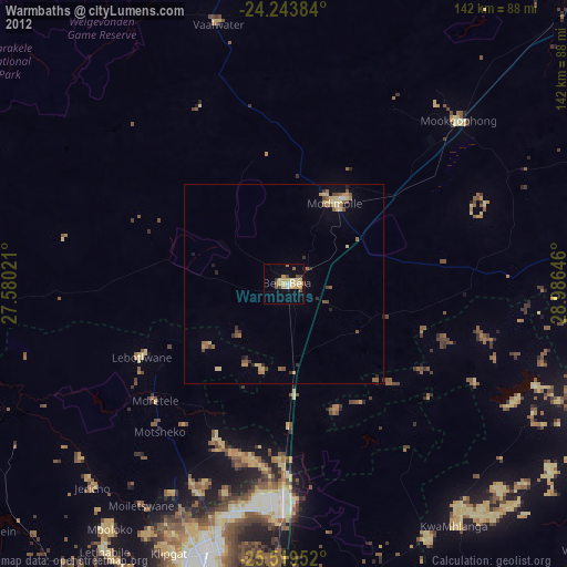
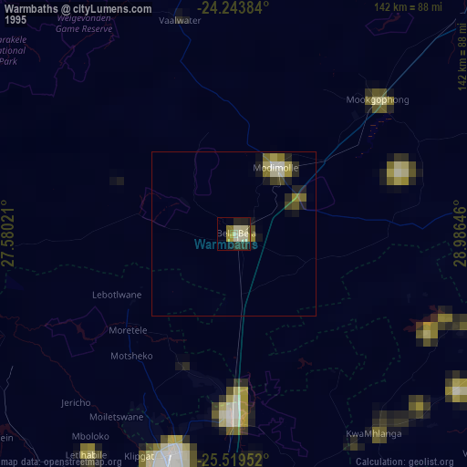
» NASA, Earths city lights 1995
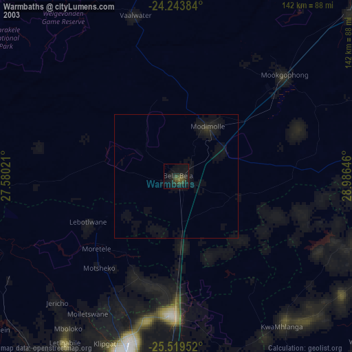
» NASA city lights 2003
» Earth at Night: Flat Maps 2012, 2016