Brits night lights from space
Night Light of Brits (North-West) from space (South Africa) Src. Average luminocity for 10x10km area is 52.9886% and for 50x50km: 25.7816%.
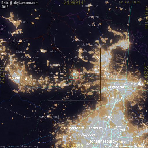
Analysis of Brits night lights 2016
Square area 10x10 km:
 5.3%
5.3%90-99
5.68%80-89
9.09%70-79
11.93%60-69
11.17%50-59
4.55%40-49
15.15%30-39
11.74%20-29
16.29%10-19
9.09%0-9
0%Square area 50x50 km:
0.8%90-99
1.12%80-89
2.15%70-79
5.96%60-69
6.05%50-59
3.23%40-49
7.38%30-39
6.88%20-29
11.23%10-19
18.48%0-9
36.72%Clear (daylight) street map image can be seen on geolist.org.
Map coordinates:
24° 59' 56.9" South, 27° 4' 37.6" East
25° 38' 5" South, 27° 46' 48.8" East
26° 16' 1" South, 28° 29' 0.1" East
Some cities around Brits sort by population:
• Pretoria
42.6 km =26.5 mi,  106°
106°
• Krugersdorp
50.2 km =31.2 mi,  180°
180°
• Diepsloot
40.5 km =25.2 mi,  145°
145°
• Centurion
47.7 km =29.6 mi,  121°
121°
• Midrand
52.6 km =32.7 mi,  138°
138°
• Mabopane
35.6 km =22.1 mi,  64°
64°
• Ga-Rankuwa
21.6 km =13.4 mi,  84°
84°
• Midstream
52.5 km =32.6 mi,  126°
126°
1015621 (p: 122,497)
Sources (retrieved 2019-11-25):
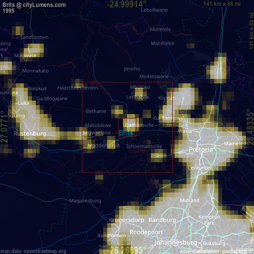
» NASA, Earths city lights 1995
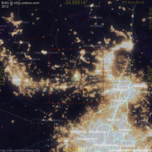
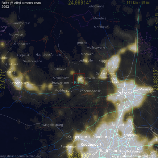
» NASA city lights 2003
» Earth at Night: Flat Maps 2012, 2016