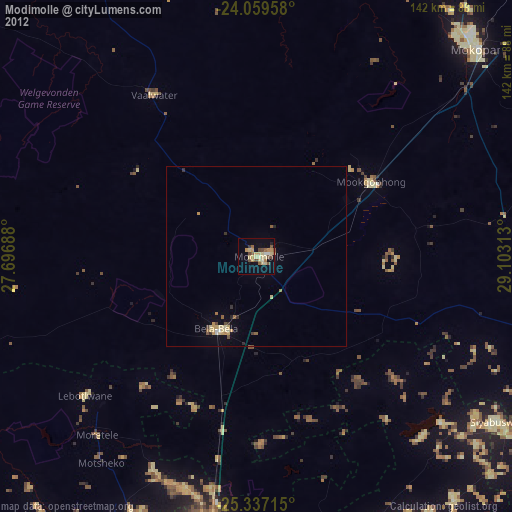
Modimolle night lights from space
Night Light of Modimolle (Limpopo) from space (South Africa) Src. Average luminocity for 10x10km area is 22.129% and for 50x50km: 1.8728%.
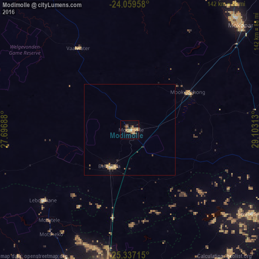
Analysis of Modimolle night lights 2016
Square area 10x10 km:
 0%
0%90-99
0.79%80-89
4.56%70-79
8.13%60-69
5.56%50-59
2.38%40-49
1.59%30-39
2.58%20-29
2.18%10-19
11.31%0-9
60.91%Square area 50x50 km:
0%90-99
0.06%80-89
0.39%70-79
0.63%60-69
0.35%50-59
0.12%40-49
0.16%30-39
0.31%20-29
0.28%10-19
0.63%0-9
97.07%Clear (daylight) street map image can be seen on geolist.org.
Map coordinates:
24° 3' 34.5" South, 27° 41' 48.8" East
24° 42' 0" South, 28° 24' 0" East
25° 20' 13.7" South, 29° 6' 11.3" East
Some cities around Modimolle sort by population:
• Mokopane
83.5 km =51.9 mi,  47°
47°
• Mabopane
93.7 km =58.2 mi,  198°
198°
• Warmbaths
23.5 km =14.6 mi,  210°
210°
• Ga-Rankuwa
109.8 km =68.2 mi, 201°
• Ekangala
116.2 km =72.2 mi,  162°
162°
• Siyabuswa
79.6 km =49.5 mi,  125°
125°
• Cullinan
108.7 km =67.5 mi,  173°
173°
• Thabazimbi
100.6 km =62.5 mi,  276°
276°
968665 (p: 20,527)
Sources (retrieved 2019-11-25):
» Earth at Night: Flat Maps 2012, 2016