Pretoria night lights from space
Night Light of Pretoria (Gauteng) from space (South Africa) Src. Average luminocity for 10x10km area is 94.6742% and for 50x50km: 61.2961%.
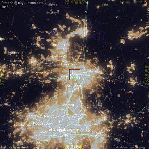
Analysis of Pretoria night lights 2016
Square area 10x10 km:
 37.88%
90-99
37.69%80-89
21.21%70-79
3.22%60-69
0%50-59
0%40-49
0%30-39
0%20-29
0%10-19
0%0-9
0%Square area 50x50 km:
9.87%90-99
12.62%80-89
11.13%70-79
14.48%60-69
9.48%50-59
7.25%40-49
8.23%30-39
6.83%20-29
7.65%10-19
6.98%0-9
5.48%Clear (daylight) street map image can be seen on geolist.org.
Map coordinates:
25° 6' 35.5" South, 27° 29' 5" East
25° 44' 41.5" South, 28° 11' 16.2" East
26° 22' 35.4" South, 28° 53' 27.5" East
Some cities around Pretoria sort by population:
• Tembisa
28.2 km =17.5 mi,  172°
172°
• Diepsloot
27.3 km =17 mi,  220°
220°
• Centurion
12.7 km =7.9 mi,  180°
180°
• Midrand
27.8 km =17.3 mi,  192°
192°
• Mabopane
28.8 km =17.9 mi,  342°
342°
• Ga-Rankuwa
24 km =14.9 mi,  306°
306°
• Cullinan
34.6 km =21.5 mi,  76°
76°
• Midstream
19.3 km =12 mi, 176°
964137 (p: 1,619,438)
Sources (retrieved 2019-11-25):
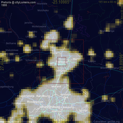
» NASA, Earths city lights 1995
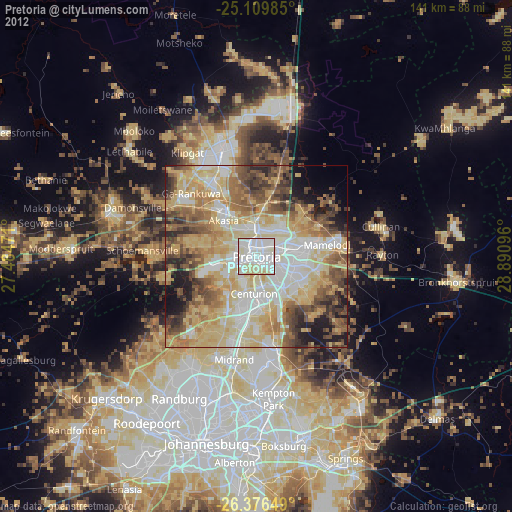
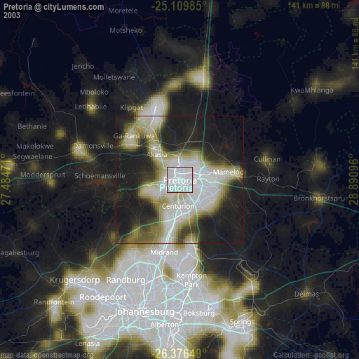
» NASA city lights 2003
» Earth at Night: Flat Maps 2012, 2016