Uitenhage night lights from space
Night Light of Uitenhage (Eastern Cape) from space (South Africa) Src. Average luminocity for 10x10km area is 55.1245% and for 50x50km: 17.0791%.
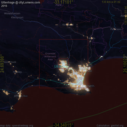
Analysis of Uitenhage night lights 2016
Square area 10x10 km:
 11.17%
90-99
12.09%80-89
4.95%70-79
10.81%60-69
8.61%50-59
7.51%40-49
4.76%30-39
3.66%20-29
16.85%10-19
17.77%0-9
1.83%Square area 50x50 km:
3.96%90-99
3.73%80-89
1.32%70-79
2.57%60-69
2.46%50-59
1.83%40-49
1.86%30-39
2.42%20-29
4.27%10-19
5.82%0-9
69.76%Clear (daylight) street map image can be seen on geolist.org.
Map coordinates:
33° 10' 15.6" South, 24° 41' 38.3" East
33° 45' 27.3" South, 25° 23' 49.6" East
34° 20' 24.5" South, 26° 6' 0.8" East
Some cities around Uitenhage sort by population:
• Port Elizabeth
30.3 km =18.8 mi,  138°
138°
• Grahamstown
116.7 km =72.5 mi,  64°
64°
• Fort Beaufort
158.6 km =98.5 mi,  46°
46°
• Kruisfontein
67.3 km =41.8 mi,  246°
246°
• Port Alfred
138.8 km =86.2 mi,  82°
82°
• Somerset East
116.5 km =72.4 mi,  8°
8°
• Adelaide
143.6 km =89.2 mi,  35°
35°
• Kirkwood
40.2 km =25 mi, 6°
946877 (p: 228,912)
Sources (retrieved 2019-11-25):
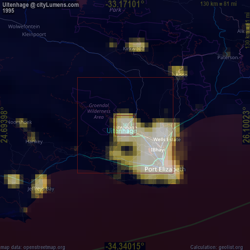
» NASA, Earths city lights 1995
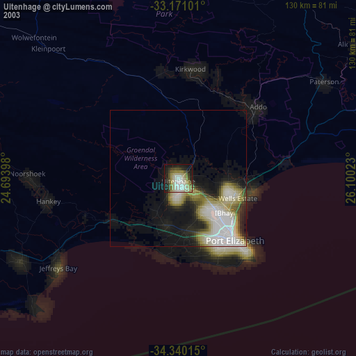
» NASA city lights 2003
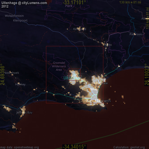
» Earth at Night: Flat Maps 2012, 2016