Theunissen night lights from space
Night Light of Theunissen (Orange Free State) from space (South Africa) Src. Average luminocity for 10x10km area is 7.6687% and for 50x50km: 0.8218%.
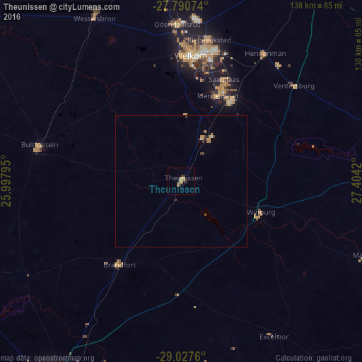
Analysis of Theunissen night lights 2016
Square area 10x10 km:
 0%
0%90-99
0%80-89
0.79%70-79
2.18%60-69
2.58%50-59
1.59%40-49
1.98%30-39
1.79%20-29
0.99%10-19
0%0-9
88.1%Square area 50x50 km:
0.01%90-99
0.05%80-89
0.07%70-79
0.29%60-69
0.16%50-59
0.09%40-49
0.15%30-39
0.21%20-29
0.09%10-19
0.04%0-9
98.84%Clear (daylight) street map image can be seen on geolist.org.
Map coordinates:
27° 47' 26.7" South, 25° 59' 52.6" East
28° 24' 39.5" South, 26° 42' 3.9" East
29° 1' 39.4" South, 27° 24' 15.1" East
Some cities around Theunissen sort by population:
• Welkom
48.3 km =30 mi,  3°
3°
• Virginia
37.8 km =23.5 mi,  25°
25°
• Kutloanong
64.4 km =40 mi, 4°
• Wesselsbron
70 km =43.5 mi,  332°
332°
• Hennenman
57.8 km =35.9 mi, 33°
• Brandfort
39.9 km =24.8 mi,  216°
216°
• Winburg
32.4 km =20.1 mi,  111°
111°
• Ventersburg
56 km =34.8 mi,  49°
49°
949282 (p: 34,718)
Sources (retrieved 2019-11-25):
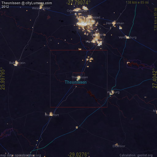
» Earth at Night: Flat Maps 2012, 2016