Kutloanong night lights from space
Night Light of Kutloanong (Orange Free State) from space (South Africa) Src. Average luminocity for 10x10km area is 16.9905% and for 50x50km: 7.4456%.
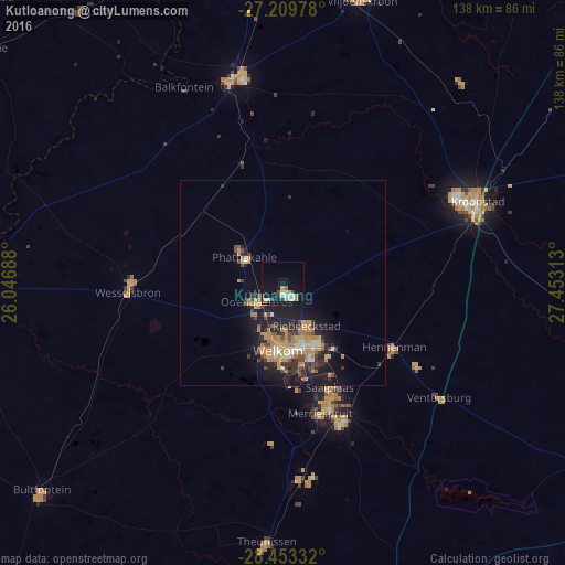
Analysis of Kutloanong night lights 2016
Square area 10x10 km:
 3.41%
3.41%90-99
3.22%80-89
1.7%70-79
2.08%60-69
1.14%50-59
1.33%40-49
2.84%30-39
0.95%20-29
0.95%10-19
14.02%0-9
68.37%Square area 50x50 km:
0.57%90-99
0.71%80-89
0.5%70-79
2.19%60-69
1.26%50-59
0.67%40-49
1.19%30-39
1.24%20-29
2.02%10-19
6.63%0-9
83.01%Clear (daylight) street map image can be seen on geolist.org.
Map coordinates:
27° 12' 35.2" South, 26° 2' 48.8" East
27° 49' 60" South, 26° 45' 0" East
28° 27' 12" South, 27° 27' 11.3" East
Some cities around Kutloanong sort by population:
• Welkom
16.1 km =10 mi,  185°
185°
• Virginia
32.2 km =20 mi,  159°
159°
• Kroonstad
51.9 km =32.2 mi,  66°
66°
• Bothaville
51.1 km =31.8 mi,  345°
345°
• Wesselsbron
37.8 km =23.5 mi,  266°
266°
• Allanridge
13.6 km =8.5 mi,  310°
310°
• Hennenman
31.3 km =19.4 mi,  120°
120°
• Ventersburg
47.3 km =29.4 mi,  126°
126°
986083 (p: 95,008)
Sources (retrieved 2019-11-25):
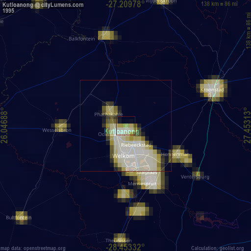
» NASA, Earths city lights 1995
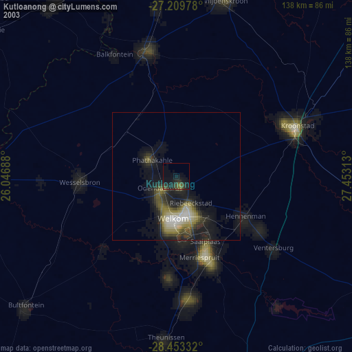
» NASA city lights 2003
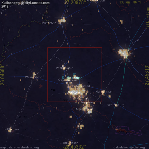
» Earth at Night: Flat Maps 2012, 2016