Brandfort night lights from space
Night Light of Brandfort (Orange Free State) from space (South Africa) Src. Average luminocity for 10x10km area is 6.7424% and for 50x50km: 0.3652%.
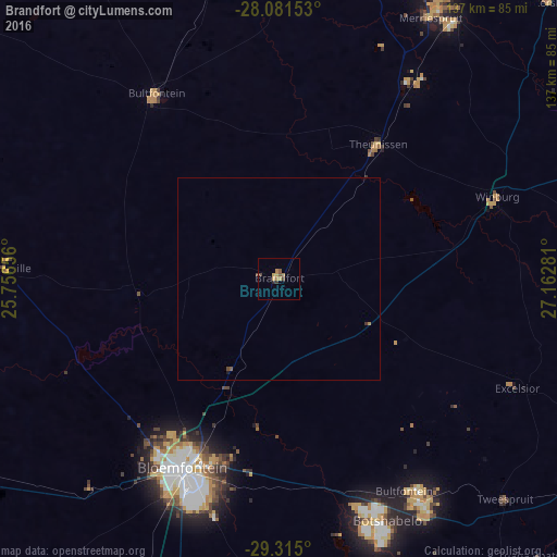
Analysis of Brandfort night lights 2016
Square area 10x10 km:
 0%
0%90-99
0%80-89
0.38%70-79
2.84%60-69
2.08%50-59
1.33%40-49
1.7%30-39
0.76%20-29
0.76%10-19
0%0-9
90.15%Square area 50x50 km:
0%90-99
0%80-89
0.01%70-79
0.11%60-69
0.11%50-59
0.08%40-49
0.13%30-39
0.07%20-29
0.03%10-19
0.03%0-9
99.42%Clear (daylight) street map image can be seen on geolist.org.
Map coordinates:
28° 4' 53.5" South, 25° 45' 23.6" East
28° 42' 0.3" South, 26° 27' 34.8" East
29° 18' 54" South, 27° 9' 46.1" East
Some cities around Brandfort sort by population:
• Bloemfontein
52.6 km =32.7 mi,  207°
207°
• Welkom
84.8 km =52.7 mi,  18°
18°
• Botshabelo
68.2 km =42.4 mi,  157°
157°
• Virginia
77.3 km =48 mi,  30°
30°
• Wesselsbron
94.4 km =58.7 mi,  354°
354°
• Thaba Nchu
67.6 km =42 mi,  146°
146°
• Theunissen
39.9 km =24.8 mi,  36°
36°
• Winburg
57.3 km =35.6 mi,  69°
69°
1015969 (p: 12,091)
Sources (retrieved 2019-11-25):
» Earth at Night: Flat Maps 2012, 2016