Phuthaditjhaba night lights from space
Night Light of Phuthaditjhaba (Orange Free State) from space (South Africa) Src. Average luminocity for 10x10km area is 53.6052% and for 50x50km: 4.6454%.
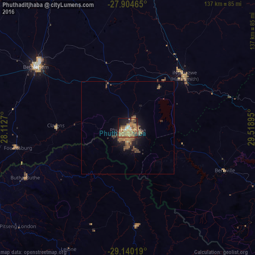
Analysis of Phuthaditjhaba night lights 2016
Square area 10x10 km:
 3.37%
3.37%90-99
2.98%80-89
2.38%70-79
25.4%60-69
20.24%50-59
7.94%40-49
7.54%30-39
3.97%20-29
9.52%10-19
13.29%0-9
3.37%Square area 50x50 km:
0.13%90-99
0.13%80-89
0.12%70-79
1.36%60-69
1.72%50-59
0.81%40-49
0.94%30-39
0.78%20-29
1.03%10-19
3.23%0-9
89.77%Clear (daylight) street map image can be seen on geolist.org.
Map coordinates:
27° 54' 16.7" South, 28° 6' 45.7" East
28° 31' 27.2" South, 28° 48' 57" East
29° 8' 24.7" South, 29° 31' 8.2" East
Some cities around Phuthaditjhaba sort by population:
• Bethlehem
59.5 km =37 mi,  303°
303°
• Leribe, LS
84.5 km =52.5 mi,  242°
242°
• Harrismith
41.5 km =25.8 mi,  47°
47°
• Maputsoe, LS
98.1 km =61 mi,  245°
245°
• Reitz
88.9 km =55.2 mi,  334°
334°
• Butha-Buthe, LS
61.5 km =38.2 mi, 244°
• Mokhotlong, LS
88.5 km =55 mi,  163°
163°
• Thaba-Tseka, LS
112.8 km =70.1 mi,  190°
190°
965401 (p: 84,258)
Sources (retrieved 2019-11-25):
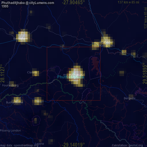
» NASA, Earths city lights 1995
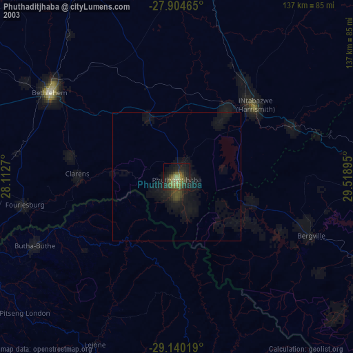
» NASA city lights 2003
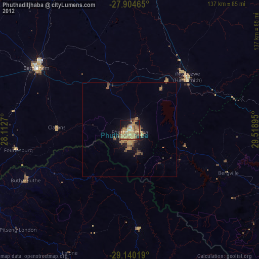
» Earth at Night: Flat Maps 2012, 2016