Mooirivier night lights from space
Night Light of Mooirivier (KwaZulu-Natal) from space (South Africa) Src. Average luminocity for 10x10km area is 6.2361% and for 50x50km: 1.3317%.
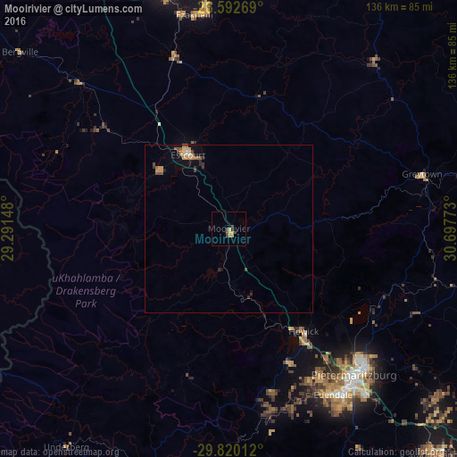
Analysis of Mooirivier night lights 2016
Square area 10x10 km:
 0%
0%90-99
0.79%80-89
1.79%70-79
1.39%60-69
0%50-59
0.79%40-49
2.78%30-39
1.19%20-29
0%10-19
0.79%0-9
90.48%Square area 50x50 km:
0.07%90-99
0.05%80-89
0.2%70-79
0.33%60-69
0.16%50-59
0.26%40-49
0.33%30-39
0.19%20-29
0.18%10-19
0.43%0-9
97.79%Clear (daylight) street map image can be seen on geolist.org.
Map coordinates:
28° 35' 33.7" South, 29° 17' 29.3" East
29° 12' 29.7" South, 29° 59' 40.6" East
29° 49' 12.4" South, 30° 41' 51.8" East
Some cities around Mooirivier sort by population:
• Pietermaritzburg
59.6 km =37 mi,  139°
139°
• Mpumalanga
91.5 km =56.9 mi, 137°
• Richmond
78.5 km =48.8 mi,  159°
159°
• Howick
37.7 km =23.4 mi, 142°
• Mpophomeni
44.1 km =27.4 mi, 155°
• Ekuvukeni
83.8 km =52.1 mi,  10°
10°
• Greytown
60.3 km =37.5 mi,  74°
74°
• Mokhotlong, LS
90.4 km =56.2 mi,  264°
264°
974222 (p: 10,132)
Sources (retrieved 2019-11-25):
» Earth at Night: Flat Maps 2012, 2016